Category:18th-century maps of Benin
Jump to navigation
Jump to search
Countries of Africa: Algeria · Angola · Benin · Cameroon · Cape Verde · Chad · Democratic Republic of the Congo · Republic of the Congo · Djibouti · Egypt‡ · Equatorial Guinea · Eritrea · Ethiopia · The Gambia · Ghana · Guinea · Ivory Coast · Libya · Madagascar · Mauritania · Morocco · Mozambique · Senegal · Sierra Leone · Somalia · South Africa · Sudan · Tanzania · Tunisia
Other areas: Canary Islands · Madeira · Western Sahara
‡: partly located in Africa
Other areas: Canary Islands · Madeira · Western Sahara
‡: partly located in Africa
Media in category "18th-century maps of Benin"
The following 4 files are in this category, out of 4 total.
-
-
-
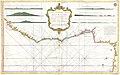
 Gerard van Keulen - Slavenkust (1716).jpg 2,972 × 1,773; 1.83 MB
-
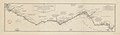
 Map of Slave Coast-1789.jpg 3,157 × 1,889; 2.45 MB

.jpg)

_-_par_le_S(ieur)_d%27Anville,_G%C3%A9ographe_Ord(inaire)_du_Roi,_Juillet_1729..._-_btv1b530532334.jpg)