Category:18th-century maps of Norfolk, England
Jump to navigation
Jump to search
Ceremonial counties of England: Bedfordshire · Berkshire · Buckinghamshire · Cambridgeshire · Cheshire · Cornwall · Derbyshire · Devon · Dorset · Durham · Essex · Gloucestershire · Greater London · Hampshire · Herefordshire · Hertfordshire · Isle of Wight · Kent · Lancashire · Leicestershire · Lincolnshire · Norfolk · Northamptonshire · Northumberland · Nottinghamshire · Oxfordshire · Rutland · Shropshire · Somerset · Staffordshire · Suffolk · Surrey · Warwickshire · Wiltshire · Worcestershire
City-counties:
Former historic counties: Cumberland · Huntingdonshire · Middlesex · Sussex · Westmorland · Yorkshire
Other former counties:
City-counties:
Former historic counties: Cumberland · Huntingdonshire · Middlesex · Sussex · Westmorland · Yorkshire
Other former counties:
Media in category "18th-century maps of Norfolk, England"
The following 8 files are in this category, out of 8 total.
-
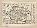 Norfolk - By H. Moll Geographer - btv1b53056714p.jpg 4,168 × 3,120; 1.88 MB
-

-

-

-

-
 1797 Faden (Mousehold Heath).jpg 1,600 × 1,132; 1.08 MB
-
 Faden 1797 map of Norfolk - Walcott extract.png 686 × 286; 254 KB
-
 Print, map (BM 1848,0212.11).jpg 1,670 × 2,500; 1.31 MB

%27_(11217232025).jpg)
.jpg)

_what_Parishes_are_Rectories_%26_what_Vicarages_;_where_Charity..._-_btv1b53057278d.jpg)
.jpg)

.jpg)