Category:18th-century maps of Bedfordshire
Jump to navigation
Jump to search
Ceremonial counties of England: Bedfordshire · Berkshire · Buckinghamshire · Cambridgeshire · Cheshire · Cornwall · Derbyshire · Devon · Dorset · Durham · Essex · Gloucestershire · Greater London · Hampshire · Herefordshire · Hertfordshire · Isle of Wight · Kent · Lancashire · Leicestershire · Lincolnshire · Norfolk · Northamptonshire · Northumberland · Nottinghamshire · Oxfordshire · Rutland · Shropshire · Somerset · Staffordshire · Suffolk · Surrey · Warwickshire · Wiltshire · Worcestershire
City-counties:
Former historic counties: Cumberland · Huntingdonshire · Middlesex · Sussex · Westmorland · Yorkshire
Other former counties:
City-counties:
Former historic counties: Cumberland · Huntingdonshire · Middlesex · Sussex · Westmorland · Yorkshire
Other former counties:
Media in category "18th-century maps of Bedfordshire"
The following 4 files are in this category, out of 4 total.
-
 Bedfordshire 17th Century.jpg 3,228 × 2,892; 1.26 MB
-
 Bedford Shire - By H. Moll Geographer - btv1b53056944p.jpg 4,024 × 2,952; 1.75 MB
-

-
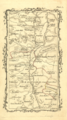 Armstrong stage map 1776.png 298 × 532; 325 KB


