Category:1899 maps of California
Jump to navigation
Jump to search
States of the United States: California · Delaware · Florida · Georgia · Illinois · Iowa · Kansas · Kentucky · Louisiana · Maine · Maryland · Massachusetts · Michigan · Minnesota · Mississippi · Missouri · Montana · Nevada · New Hampshire · New Jersey · New Mexico · New York · Ohio · Oklahoma · Oregon · Pennsylvania · Rhode Island · South Carolina · South Dakota · Tennessee · Texas · Vermont · Virginia · Washington · West Virginia · Wisconsin – Washington, D.C.
| ← 1890 1891 1892 1893 1894 1895 1896 1897 1898 1899 → |
Subcategories
This category has the following 8 subcategories, out of 8 total.
B
C
Media in category "1899 maps of California"
The following 70 files are in this category, out of 70 total.
-
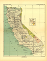 1896 California Map 2 Smithsonian Institute Report.png 1,900 × 2,477; 9.31 MB
-
 1896 California Map Smithsonian Institute Report.png 1,918 × 2,389; 9.46 MB
-

-

-
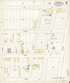
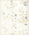
 Sanborn Fire Insurance Map from Auburn, Placer County, California. LOC sanborn00398 003-1.tif 6,450 × 7,650; 141.17 MB
-

-
 Sanborn Fire Insurance Map from Auburn, Placer County, California. LOC sanborn00398 003-2.tif 6,450 × 7,650; 141.17 MB
-

-
 Sanborn Fire Insurance Map from Auburn, Placer County, California. LOC sanborn00398 003-3.tif 6,450 × 7,650; 141.17 MB
-

-
 Sanborn Fire Insurance Map from Auburn, Placer County, California. LOC sanborn00398 003-4.tif 6,450 × 7,650; 141.17 MB
-

-
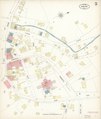 Sanborn Fire Insurance Map from Auburn, Placer County, California. LOC sanborn00398 003-5.tif 6,450 × 7,650; 141.17 MB
-
-
 Sanborn Fire Insurance Map from Auburn, Placer County, California. LOC sanborn00398 003-6.tif 6,450 × 7,650; 141.17 MB
-

-
 Sanborn Fire Insurance Map from Auburn, Placer County, California. LOC sanborn00398 003-7.tif 6,450 × 7,650; 141.17 MB
-

-

-

-

-

-
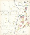
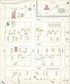
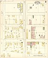
 Sanborn Fire Insurance Map from Baden, San Mateo County, California. LOC sanborn00403 002-1.tif 6,450 × 7,650; 141.17 MB
-
-
 Sanborn Fire Insurance Map from Baden, San Mateo County, California. LOC sanborn00403 002-2.tif 6,450 × 7,650; 141.17 MB
-

-
 Sanborn Fire Insurance Map from Baden, San Mateo County, California. LOC sanborn00403 002-3.tif 6,450 × 7,650; 141.17 MB
-

-
 Sanborn Fire Insurance Map from Baden, San Mateo County, California. LOC sanborn00403 002-4.tif 6,450 × 7,650; 141.17 MB
-
 California mines and minerals (1899) (14596021289).jpg 3,188 × 2,790; 852 KB
-
 California mines and minerals (1899) (14759698326).jpg 2,592 × 3,350; 718 KB
-
 California mines and minerals (1899) (14779515321).jpg 3,120 × 1,370; 875 KB
-
 California mines and minerals (1899) (14782662685).jpg 3,016 × 1,438; 954 KB
-

-
 Sanborn Fire Insurance Map from Corning, Tehama County, California. LOC sanborn00481 003-1.tif 6,450 × 7,650; 141.17 MB
-

-
 Sanborn Fire Insurance Map from Corning, Tehama County, California. LOC sanborn00481 003-2.tif 6,450 × 7,650; 141.17 MB
-

-
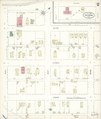
 Sanborn Fire Insurance Map from Folsom, Sacramento County, California. LOC sanborn00546 002-1.tif 6,450 × 7,650; 141.17 MB
-
-
 Sanborn Fire Insurance Map from Folsom, Sacramento County, California. LOC sanborn00546 002-2.tif 6,450 × 7,650; 141.17 MB
-

-
 Sanborn Fire Insurance Map from Geyserville, Sonoma County, California. LOC sanborn00565 002.tif 6,450 × 7,650; 141.17 MB
-
 Image taken from page 161 of 'Advanced Geography' (16403190630).jpg 560 × 747; 136 KB
-
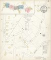
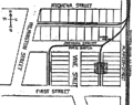 Map of proposed warehouse center in Los Angeles, California, 1899.png 759 × 602; 148 KB
-
-
 Sanborn Fire Insurance Map from Roseville, Placer County, California. LOC sanborn00797 003-1.tif 6,450 × 7,650; 141.17 MB
-

-
 Sanborn Fire Insurance Map from Roseville, Placer County, California. LOC sanborn00797 003-2.tif 6,450 × 7,650; 141.17 MB
-
 San Francisco, California, 1899, 15-minute topographic map.png 1,201 × 851; 2.52 MB
-

-
 Sanborn Fire Insurance Map from Glen Ellen, Sonoma County, California. LOC sanborn00567 001.tif 6,450 × 7,650; 141.17 MB
-

-

-

-
 Sanborn Fire Insurance Map from Newcastle, Placer County, California. LOC sanborn00714 001.tif 6,450 × 7,650; 141.17 MB
-
 Sanborn Fire Insurance Map from Wheatland, Yuba County, California. LOC sanborn00929 003-1.jpg 8,687 × 10,288; 5.83 MB
-
 Sanborn Fire Insurance Map from Wheatland, Yuba County, California. LOC sanborn00929 003-2.jpg 8,668 × 10,314; 5.65 MB
-
 Sanborn Fire Insurance Map from Wheatland, Yuba County, California. LOC sanborn00929 003-3.jpg 8,704 × 10,294; 5.69 MB
-
 Sanborn Fire Insurance Map from Wheatland, Yuba County, California. LOC sanborn00929 003-3.tif 8,704 × 10,294; 256.34 MB
-

-
 Sanborn Fire Insurance Map from Yuba City, Sutter County, California. LOC sanborn00943 002-1.tif 6,450 × 7,650; 141.17 MB
-

-
 Sanborn Fire Insurance Map from Yuba City, Sutter County, California. LOC sanborn00943 002-2.tif 6,450 × 7,650; 141.17 MB
-

-
 Sanborn Fire Insurance Map from Yuba City, Sutter County, California. LOC sanborn00943 002-3.tif 6,450 × 7,650; 141.17 MB
-

-
 Sanborn Fire Insurance Map from Yuba City, Sutter County, California. LOC sanborn00943 002-4.tif 6,450 × 7,650; 141.17 MB
-

-
 Sanborn Fire Insurance Map from Yuba City, Sutter County, California. LOC sanborn00943 002-5.tif 6,450 × 7,650; 141.17 MB


%27_(11169071483).jpg)


_(14596021289).jpg)
_(14759698326).jpg)
_(14779515321).jpg)
_(14782662685).jpg)


.jpg)


