Category:1895 maps of Ohio
Jump to navigation
Jump to search
States of the United States: California · Connecticut · Florida · Georgia · Illinois · Iowa · Kentucky · Louisiana · Maryland · Michigan · Minnesota · Mississippi · Missouri · New Jersey · New York · Ohio · Oklahoma · Oregon · Pennsylvania · South Carolina · Texas · Utah · Virginia · Washington · West Virginia · Wisconsin · Wyoming – Washington, D.C.
| ← 1890 1891 1892 1893 1894 1895 1896 1897 1898 1899 → |
Subcategories
This category has the following 7 subcategories, out of 7 total.
S
Media in category "1895 maps of Ohio"
The following 25 files are in this category, out of 25 total.
-

-
 1895 Stranahan Map of Ohio.jpg 9,509 × 7,602; 11.09 MB
-

-
 Cleveland West Side, 1895 - DPLA - 0f3b757a3e5cf337534f9e52b7dc0513.jpg 6,499 × 2,403; 1.72 MB
-
 Detailed map of Ohio in 1895.jpg 2,593 × 1,692; 1.72 MB
-
 Map of Franklin County, Ohio LOC 2012592222.jpg 16,029 × 11,916; 35.21 MB
-
 Sanborn Fire Insurance Map from Bowerston, Harrison County, Ohio. LOC sanborn06607 001.jpg 6,510 × 7,707; 3.41 MB
-
 Sanborn Fire Insurance Map from Bowerston, Harrison County, Ohio. LOC sanborn06607 001.tif 6,510 × 7,707; 143.55 MB
-
 Sanborn Fire Insurance Map from Dunkirk, Hardin County, Ohio. LOC sanborn06684 001.jpg 6,510 × 7,707; 4.18 MB
-
 Sanborn Fire Insurance Map from Dunkirk, Hardin County, Ohio. LOC sanborn06684 001.tif 6,510 × 7,707; 143.55 MB
-
 Sanborn Fire Insurance Map from Edgerton, Williams County, Ohio. LOC sanborn06688 001.jpg 6,510 × 7,707; 3.85 MB
-
 Sanborn Fire Insurance Map from Edgerton, Williams County, Ohio. LOC sanborn06688 001.tif 6,510 × 7,707; 143.55 MB
-
 Sanborn Fire Insurance Map from Kingston, Ross County, Ohio. LOC sanborn06750 001.jpg 6,510 × 7,707; 3.79 MB
-
 Sanborn Fire Insurance Map from Kingston, Ross County, Ohio. LOC sanborn06750 001.tif 6,510 × 7,707; 143.55 MB
-
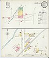 Sanborn Fire Insurance Map from Louisville, Stark County, Ohio. LOC sanborn06772 001-1.jpg 6,510 × 7,707; 3.17 MB
-
 Sanborn Fire Insurance Map from Martinsville, Clinton County, Ohio. LOC sanborn06789 001.jpg 6,510 × 7,707; 3.43 MB
-
 Sanborn Fire Insurance Map from Martinsville, Clinton County, Ohio. LOC sanborn06789 001.tif 6,510 × 7,707; 143.55 MB
-

-
 Sanborn Fire Insurance Map from Sherrodsville, Carroll County, Ohio. LOC sanborn06892 001.tif 6,510 × 7,707; 143.55 MB
-
 Sanborn Fire Insurance Map from Swanton, Fulton County, Ohio. LOC sanborn06904 001.jpg 6,510 × 7,707; 3.68 MB
-
 Sanborn Fire Insurance Map from Swanton, Fulton County, Ohio. LOC sanborn06904 001.tif 6,510 × 7,707; 143.55 MB
-
 Sanborn Fire Insurance Map from Waldo, Marion County, Ohio. LOC sanborn06926 001.jpg 6,510 × 7,707; 3.32 MB
-
 Sanborn Fire Insurance Map from Waldo, Marion County, Ohio. LOC sanborn06926 001.tif 6,510 × 7,707; 143.55 MB
-

-
 Sanborn Fire Insurance Map from West Manchester, Preble County, Ohio. LOC sanborn06947 001.tif 6,510 × 7,707; 143.55 MB
.jpg)


