Category:1892 maps of North Dakota
Jump to navigation
Jump to search
States of the United States: California · Connecticut · Florida · Georgia · Idaho · Illinois · Iowa · Kansas · Kentucky · Louisiana · Maryland · Michigan · Minnesota · Mississippi · Missouri · Montana · New Jersey · New York · North Carolina · North Dakota · Ohio · Oregon · Pennsylvania · South Carolina · South Dakota · Tennessee · Texas · Washington · Wisconsin – Washington, D.C.
| 1892 1893 1897 1898 → |
Subcategories
This category has only the following subcategory.
Media in category "1892 maps of North Dakota"
The following 5 files are in this category, out of 5 total.
-

-
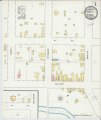 Sanborn Fire Insurance Map from Pembina, Pembina County, North Dakota. LOC sanborn06562 002-1.tif 6,510 × 7,707; 143.55 MB
-

-
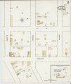 Sanborn Fire Insurance Map from Pembina, Pembina County, North Dakota. LOC sanborn06562 002-2.tif 6,510 × 7,707; 143.55 MB
-
 SpiritLakeRes1892.png 2,366 × 1,841; 8.58 MB


