Category:1890s maps of Zimbabwe
Jump to navigation
Jump to search
Media in category "1890s maps of Zimbabwe"
The following 25 files are in this category, out of 25 total.
-
-
-

-

-
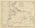
 111 of 'The Goldfields of Mashonaland. (With maps and plans.)' (11225496693).jpg 2,431 × 3,537; 932 KB
-

-
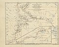
 113 of 'The Goldfields of Mashonaland. (With maps and plans.)' (11229964914).jpg 2,478 × 3,367; 825 KB
-
 114 of 'In the Land of Cecil Rhodes' (11238247364).jpg 1,888 × 1,280; 496 KB
-
 115 of 'The Goldfields of Mashonaland. (With maps and plans.)' (11228515143).jpg 4,553 × 3,417; 1.64 MB
-

-
 125 of 'The Goldfields of Mashonaland. (With maps and plans.)' (11225522206).jpg 2,564 × 2,770; 712 KB
-
-

-

-
-

-

-

-
-
 Fletcher and Espin's Map of Matabeleland - btv1b530293432.jpg 14,353 × 15,229; 21.02 MB
-

-

-
-

-
 Map of part of Matabeliland - btv1b8441512d.jpg 6,228 × 7,849; 5.8 MB
)%27_(11221476476).jpg)
%27_(11218736476).jpg)
.jpg)
%27_(11218932966).jpg)
%27_(11225496693).jpg)
.jpg)
%27_(11229964914).jpg)
.jpg)
%27_(11228515143).jpg)
.jpg)
%27_(11225522206).jpg)
.jpg)
.jpg)
%27_(11217936264).jpg)
%27_(11218429085).jpg)
%27_(11215466376).jpg)
.jpg)
.jpg)
.jpg)


%27_(11216920283).jpg)
%27_(16589581992).jpg)
%27_(16590241035).jpg)
