Category:1880s maps of Paris
Jump to navigation
Jump to search
Subcategories
This category has the following 3 subcategories, out of 3 total.
M
T
- The Black Stain (3 F)
Media in category "1880s maps of Paris"
The following 110 files are in this category, out of 110 total.
-
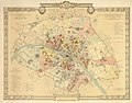
 1882 Andriveau-Goujon Pocket Map of Paris, France - Geographicus - Paris-andriveau-1882.jpg 6,000 × 4,570; 10.58 MB
-
 110 of 'Paris. Histoire-monuments-administration-environs, etc' (11198047924).jpg 1,321 × 1,942; 716 KB
-
 112 of 'Paris sous Louis XIV. Monuments et vues' (11164427216).jpg 1,561 × 2,328; 958 KB
-
 117 of 'Paris sous Louis XIV. Monuments et vues' (11284476345).jpg 1,126 × 1,465; 414 KB
-
 129 of 'Paris sous Louis XIV. Monuments et vues' (11284136503).jpg 1,122 × 1,342; 421 KB
-
 135 of 'Paris sous Louis XIV. Monuments et vues' (11161973123).jpg 1,055 × 2,320; 707 KB
-
 140 of 'Paris sous Louis XIV. Monuments et vues' (11163652726).jpg 1,157 × 2,427; 603 KB
-
 151 of 'Paris sous Louis XIV. Monuments et vues' (11165501904).jpg 1,693 × 1,478; 543 KB
-
 155 of 'Paris depuis ses origines jusqu'à nos jours. Vol. 1-3' (11201871383).jpg 1,234 × 1,663; 471 KB
-

-
 173 of 'Paris sous Louis XIV. Monuments et vues' (11164103866).jpg 2,136 × 1,560; 558 KB
-
 183 of 'Paris sous Louis XIV. Monuments et vues' (11283968945).jpg 1,102 × 1,501; 415 KB
-
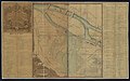
 1880 Clerot Pocket Map of Paris and Environs, France - Geographicus - Paris-clerot-1880.jpg 5,904 × 4,216; 16.09 MB
-

-

-
 1881 Lefevre Pocket Map or Plan of Paris, France - Geographicus - Paris-lefevre-1881.jpg 5,000 × 3,765; 6.34 MB
-
 1881 – Carte des Environs de Paris par le Ministère de l’ Intérieur.jpg 7,853 × 7,027; 45.81 MB
-

-
 1884 – Carte des Environs de Paris dans un rayon de 30 kilomètres.jpg 12,824 × 10,064; 23.08 MB
-
 1885. Nouveau Plan de Paris... - btv1b53022999p.jpg 10,567 × 8,046; 19.95 MB
-
-
-

-

-

-

-
 1889 Vuillemin Map of Paris, France - Geographicus - Paris-vuillemin-1889.jpg 6,000 × 4,173; 8.24 MB
-
 193 of 'Paris sous Louis XIV. Monuments et vues' (11164863706).jpg 2,235 × 1,333; 737 KB
-
 211 of 'Paris sous Louis XIV. Monuments et vues' (11163217495).jpg 2,320 × 1,832; 1.31 MB
-
 257 of 'Paris sous Louis XIV. Monuments et vues' (11162941464).jpg 1,647 × 2,313; 1,020 KB
-
 26 of 'Paris sous Louis XIV. Monuments et vues' (11164319656).jpg 1,883 × 3,065; 1.56 MB
-
 27 of 'Paris sous Louis XIV. Monuments et vues' (11164423465).jpg 1,843 × 3,046; 1.55 MB
-
 276 of 'Paris sous Louis XIV. Monuments et vues' (11165691083).jpg 951 × 2,290; 521 KB
-
 277 of 'Paris sous Louis XIV. Monuments et vues' (11164162474).jpg 2,432 × 1,737; 842 KB
-
 29 of 'Paris sous Louis XIV. Monuments et vues' (11165302755).jpg 2,315 × 1,133; 579 KB
-
 303 of 'Paris sous Louis XIV. Monuments et vues' (11163941294).jpg 2,063 × 2,517; 999 KB
-
 319 of 'Paris sous Louis XIV. Monuments et vues' (11163772205).jpg 2,197 × 1,977; 1.04 MB
-
 339 of 'Paris sous Louis XIV. Monuments et vues' (11162869306).jpg 2,285 × 1,631; 817 KB
-
 60 of 'Paris sous Louis XIV. Monuments et vues' (11283682785).jpg 1,072 × 1,983; 315 KB
-
 69 of 'Paris sous Louis XIV. Monuments et vues' (11283246834).jpg 1,106 × 1,261; 363 KB
-
 71 of 'Paris sous Louis XIV. Monuments et vues' (11163338345).jpg 1,685 × 1,415; 611 KB
-
 95 of 'Paris sous Louis XIV. Monuments et vues' (11160955396).jpg 2,333 × 1,262; 753 KB
-
 Album de statistique graphique - Recettes des lignes d'omnibus de Paris - David Rumsey.jpg 11,732 × 9,151; 71.07 MB
-

-

-

-
-
-

-

-

-
-

-
-

-
 Album de statistique graphique de 1883 - Recettes des tramways de Paris en 1881 - David Rumsey.jpg 12,728 × 9,822; 43.94 MB
-

-

-
-

-

-
 Atlas des anciens plans de Paris - Paris en 1728 - BHVP.jpg 15,224 × 12,747; 187.11 MB
-
 Atlas des anciens plans de Paris - Paris en 1728 A - BHVP.jpg 8,078 × 5,228; 12.24 MB
-
 Atlas des anciens plans de Paris - Paris en 1728 B - BHVP.jpg 7,939 × 5,202; 12.9 MB
-
 Atlas des anciens plans de Paris - Paris en 1728 C - BHVP.jpg 7,606 × 8,070; 17.9 MB
-
 Atlas des anciens plans de Paris - Paris en 1728 D - BHVP.jpg 7,710 × 8,160; 17.97 MB
-
 Carte statistique des égouts de Paris, égouts au 31 décembre 1885 - BHVP.jpg 7,908 × 6,153; 8.25 MB
-
 Charles Smith, Nouveau plan de Paris divisé en 20 arrondissements, 1880 (01) - Paris Musées.jpg 12,856 × 9,048; 66.78 MB
-

-
 Colton, The Environs of Paris, 1886 - David Rumsey.jpg 6,134 × 4,929; 11.52 MB
-
 Environs de Paris - Carte dressée par ordre du ministère de l'intérieur, 1885 - Gallica.jpg 11,076 × 8,574; 16.93 MB
-
 Environs de Paris, Département de la Seine, 1884 - Gallica.jpg 19,280 × 16,946; 60.05 MB
-
 Erhard, Environs de Paris, 1883 - David Rumsey.jpg 14,542 × 11,940; 62.53 MB
-
 Garnier frères, Nouveau Paris monumental, 1882 - David Rumsey.jpg 18,406 × 13,324; 73.63 MB
-
 Henri Dron, Paris en 1889 - Gallica.jpg 6,659 × 5,338; 7.1 MB
-
 Jouvet et Cie., Camp Retranche de Paris, 1882 - David Rumsey.jpg 8,523 × 6,669; 18.12 MB
-

-
 La France illustrée - géographie, histoire, administration, statistique (1881) - Flickr.jpg 3,884 × 2,638; 2.27 MB
-
 Lanée, Nouveau plan de Paris, 1886 - e-rara.jpg 5,439 × 4,223; 28.33 MB
-
 Les anciens hôtels de la rive gauche (1880).jpg 2,343 × 3,198; 1.5 MB
-
 Letts, City of Paris, 1883 - David Rumsey.jpg 9,021 × 6,123; 22.28 MB
-
 Letts, The environs of Paris, 1883 - David Rumsey.jpg 6,030 × 4,911; 13.8 MB
-

-
 Nouveau Plan complet illustré de la ville de Paris en 1889 by Vuillemin - Gallica.jpg 10,793 × 8,052; 18.88 MB
-
 Nouveau plan de Paris - gravé et imprimé par Erhard. 4 km. - btv1b531212364.jpg 10,802 × 8,026; 19.55 MB
-
 Nouveau plan de Paris et des communes de la banlieue by A. Vuillemin - Stanford Libraries - Original.jpg 22,798 × 17,266; 103.85 MB
-
 Nouveau plan de Paris et des communes de la banlieue by A. Vuillemin - Stanford Libraries.jpg 22,798 × 17,266; 129.33 MB
-

-

-

-

-

-
 Plan de la ville de Paris en 1789, 1887 - Stanford Libraries.jpg 15,836 × 12,589; 71.31 MB
-
 Plan de la ville de Paris en 1789, 1887 - Stanford Libraries.tif 15,836 × 12,589; 190.15 MB
-
 Plan de la ville de Paris, période révolutionnaire (1790-1794) - Paris Musées (edited).jpg 12,400 × 9,670; 72.15 MB
-
 Plan de la ville de Paris, période révolutionnaire (1790-1794) - Paris Musées.jpg 13,098 × 10,410; 82.87 MB
-
 Plan de Paris by Alexandre Vuillemin, 1889 - Stanford Libraries.jpg 13,690 × 10,947; 24.23 MB
-
 Plan de Paris by Alexandre Vuillemin, 1889 - Stanford Libraries.tif 13,690 × 10,947; 142.92 MB
-
 Plan de Sainte Barbe en 1884.jpg 480 × 509; 25 KB
-
 Plan des fiefs du Parloir-aux-bourgeois et Franc-Rosier, 1884 - BHVP.jpg 1,499 × 937; 221 KB
-
 Plan géométral de Paris à l'échelle de 0.001 pour 10 mètres - Stanford Libraries.jpg 24,540 × 16,440; 66.03 MB
-
 Plan géométral de Paris à l'échelle de 0.001 pour 10 mètres - Stanford Libraries.tif 24,540 × 16,440; 384.75 MB
-
 Plan-bijou de Paris avec les lignes du métropolitain - Penn State University Libraries.jpg 6,582 × 5,382; 7.61 MB
-

-
 Rue de la Gare 1865.jpg 732 × 597; 246 KB
-
 Rue de la Gare 1867.jpg 622 × 611; 280 KB
-
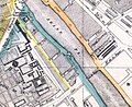
 Rue de Vouillé 1882 Andriveau.jpg 1,129 × 528; 422 KB
-
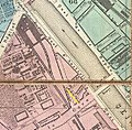
 Rue de Vouillé 1889 Vuillemin.jpg 1,150 × 590; 421 KB
-
 Service géographique de l'armée, Carte d'état-major - Paris, 1882.jpg 17,810 × 12,213; 86.42 MB
-
 Supplément au journal Le Temps du 14 avril 1886 - Gallica.jpg 8,050 × 5,252; 6.15 MB

.jpg)
.jpg)
.jpg)
.jpg)
.jpg)
.jpg)
.jpg)
.jpg)
.jpg)
.jpg)
.jpg)


.jpg)


.jpg)


.jpg)
.jpg)
.jpg)
.jpg)
.jpg)
.jpg)
.jpg)
.jpg)
.jpg)
.jpg)
.jpg)
.jpg)
.jpg)
.jpg)
.jpg)


_-_David_Rumsey.jpg)
_-_David_Rumsey.jpg)


_(14574026219).jpg)
_(14780542513).jpg)


_-_Paris_Mus%C3%A9es.jpg)
_-_Paris_Mus%C3%A9es.jpg)


_(14784080013).jpg)
_-_Flickr.jpg)

.jpg)


,_1882_-_Gallica.jpg)


_(14761113446).jpg)
_(14780965921).jpg)
_(14780969061).jpg)
_(14784093945).jpg)
_(14784109935).jpg)

_-_Paris_Mus%C3%A9es_(edited).jpg)
_-_Paris_Mus%C3%A9es.jpg)


