Category:1890s maps of Central Asia
Jump to navigation
Jump to search
English: This category is intended to collect maps from the 1890s, showing Central Asia. (Note: This is preferred over subdividing the region according to current/modern borders, unless the map title or prominent labels name a specific modern or past country.)
| 19th-century maps of Central Asia: ← 1800s 1810s 1830s 1840s 1850s 1860s 1870s 1880s 1890s |
Subcategories
This category has only the following subcategory.
Media in category "1890s maps of Central Asia"
The following 17 files are in this category, out of 17 total.
-

-

-
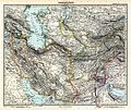
 Iran & Turan.tif 5,816 × 4,824; 80.3 MB
-
 Stielers Handatlas 1891 59.jpg 5,050 × 4,250; 7.62 MB
-

-
 Meyers leiner Hand-atlas 1893 (73137128).jpg 6,585 × 4,997; 7.1 MB
-

-
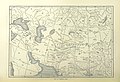
 Map of Central Asia.jpg 2,938 × 3,480; 2.66 MB
-
 Kanjut map by Younghusband.jpg 1,448 × 1,336; 1,007 KB
-
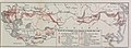
 365 of 'A Ride through Western Asia ... With illustrations' (11240309914).jpg 3,180 × 2,532; 1.25 MB
-
 367 of '(A Ride through Western Asia ... With illustrations.)' (11240452344).jpg 3,148 × 2,550; 1.24 MB
-
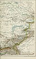
 Russland Asiatischer Teil BV043676725.jpg 7,297 × 2,705; 1.83 MB
-

-

-
 376 of '(Cassell's Illustrated History of the Russo-Turkish War, etc.)' (11206074346).jpg 2,976 × 2,013; 1.44 MB
-
 378 of 'Cassell's Illustrated History of the Russo-Turkish War' (11235936656).jpg 2,960 × 2,031; 1.5 MB
-
 Brockhaus' Konversations-Lexikon (1892) (14597836160).jpg 1,682 × 2,728; 943 KB
_oszt%C3%A1ly_sz%C3%A1mara_..._t%C3%A9rk%C3%A9ppel%27_(11203652713).jpg)
_oszt%C3%A1ly_sz%C3%A1mara_..._t%C3%A9rk%C3%A9ppel%27_(11294422295).jpg)

.jpg)
.jpg)


.jpg)
%27_(11240452344).jpg)
%27_(11250863725).jpg)
.jpg)
%27_(11206074346).jpg)
.jpg)
_(14597836160).jpg)