Category:1800s maps of Central Asia
Jump to navigation
Jump to search
English: This category is intended to collect maps from the 1800s, showing Central Asia. (Note: This is preferred over subdividing the region according to current/modern borders, unless the map title or prominent labels name a specific modern or past country.)
| 19th-century maps of Central Asia: ← 1800s 1810s 1830s 1840s 1850s 1860s 1870s 1880s 1890s |
Subcategories
This category has only the following subcategory.
1
- Asie centrale - btv1b72002855 (18 F)
Media in category "1800s maps of Central Asia"
The following 5 files are in this category, out of 5 total.
-

-

-
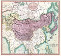 1806 Cary Map of Tartary or Central Asia - Geographicus - Tartary-cary-1806.jpg 5,000 × 4,569; 8.57 MB
-
-

_(cropped_on_Central_Asia,_Tajikistan,_Uzbekistan).jpg)
.jpg)


