Category:1889 maps of New Hampshire
Jump to navigation
Jump to search
States of the United States: California · Connecticut · Florida · Georgia · Illinois · Iowa · Kansas · Kentucky · Louisiana · Maine · Massachusetts · Michigan · Minnesota · Mississippi · Missouri · Montana · New Hampshire · New Jersey · New Mexico · New York · Ohio · Oregon · Pennsylvania · Rhode Island · South Carolina · Tennessee · Texas · Utah · Vermont · Washington · Wisconsin
| 1883 1884 1885 1886 1887 1888 1889 → |
Subcategories
This category has the following 6 subcategories, out of 6 total.
S
Media in category "1889 maps of New Hampshire"
The following 12 files are in this category, out of 12 total.
-
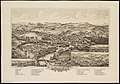 Henniker, N.H. (2675816996).jpg 2,000 × 1,401; 2.18 MB
-
 Henniker, N.H. LOC 73694685.jpg 6,304 × 4,384; 5.09 MB
-
 Henniker, N.H. LOC 73694685.tif 6,304 × 4,384; 79.07 MB
-
 Meredith Village, N.H. (2675825134).jpg 2,000 × 1,370; 1.79 MB
-
 Meredith Village, N.H. LOC 75694693.jpg 8,672 × 5,056; 9.2 MB
-
 Meredith Village, N.H. LOC 75694693.tif 8,672 × 5,056; 125.44 MB
-
 New Hampshire (4587187758).jpg 2,000 × 1,233; 3.57 MB
-

-
 Sanborn Fire Insurance Map from Warner, Sullivan County, New Hampshire. LOC sanborn05393 001.tif 6,450 × 7,650; 141.17 MB
-
 The butterflies of the eastern United States and Canada (8253398362).jpg 1,918 × 2,927; 770 KB
-
 Wolfeborough, N.H., Lake Winnipesaukee. LOC 75694705.jpg 8,432 × 5,504; 8.39 MB
-
 Wolfeborough, N.H., Lake Winnipesaukee. LOC 75694705.tif 8,432 × 5,504; 132.78 MB
.jpg)

.jpg)

.jpg)

.jpg)
