Category:1880s maps of the Bahamas
Jump to navigation
Jump to search
Countries of the Americas: Argentina · The Bahamas · Barbados · Belize · Bolivia · Brazil · Canada · Chile · Colombia · Costa Rica · Cuba · Ecuador · Guatemala · Haiti · Jamaica · Mexico · Panama · Paraguay · Peru · Saint Kitts and Nevis · United States of America · Uruguay · Venezuela
Other areas: Aruba · Puerto Rico
Other areas: Aruba · Puerto Rico
Media in category "1880s maps of the Bahamas"
The following 3 files are in this category, out of 3 total.
-
 Map of The Bahamas (1888).jpg 1,921 × 1,217; 1.11 MB
-
 Map of the Bahamas and neighbouring islands.jpg 4,344 × 3,730; 5.37 MB
-
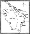 PSM V32 D328 Map of abaco island and its adjoining reef.jpg 1,587 × 1,771; 229 KB
.jpg)

