Category:1880s maps of Maine
Jump to navigation
Jump to search
States of the United States: Alabama · Alaska · Arizona · Arkansas · California · Colorado · Connecticut · Delaware · Florida · Georgia · Hawaii · Idaho · Illinois · Indiana · Iowa · Kansas · Kentucky · Louisiana · Maine · Maryland · Massachusetts · Michigan · Minnesota · Mississippi · Missouri · Montana · Nebraska · Nevada · New Hampshire · New Jersey · New Mexico · New York · North Carolina · North Dakota · Ohio · Oklahoma · Oregon · Pennsylvania · Rhode Island · South Carolina · South Dakota · Tennessee · Texas · Utah · Vermont · Virginia · Washington · West Virginia · Wisconsin · Wyoming – Washington, D.C.
Puerto Rico
Puerto Rico
Subcategories
This category has the following 5 subcategories, out of 5 total.
Media in category "1880s maps of Maine"
The following 10 files are in this category, out of 10 total.
-

-
 1881 Thomas Sedgwick Steele Map of Maine - Geographicus - Maine-steele-1881.jpg 3,498 × 5,000; 3.62 MB
-
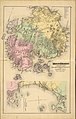 Mount Desert, adjacent islands.19137659690672130.jpg 6,111 × 9,599; 10.89 MB
-

-

-

-

-

-
-
 New England - a handbook for travelers (1880) (14578346668).jpg 3,432 × 2,512; 1.09 MB
.jpg)


.jpg)
.jpg)
.jpg)
.jpg)
.jpg)
.jpg)
_(14578346668).jpg)