Category:1880s maps of Lower Saxony
Jump to navigation
Jump to search
|
Federal states of Germany: |
Media in category "1880s maps of Lower Saxony"
The following 6 files are in this category, out of 6 total.
-
 Ostfriesland1881-MJ.jpg 12,901 × 7,771; 81.9 MB
-
 Astfala.jpg 309 × 196; 32 KB
-
-

-
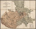
 Atlas des Deutschen Reichs - Ravenstein - 1883, page 41.jpg 5,994 × 4,792; 44.39 MB
-


