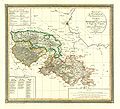
Category:1810s maps of Lower Saxony
Jump to navigation
Jump to search
|
Federal states of Germany: |
Media in category "1810s maps of Lower Saxony"
The following 5 files are in this category, out of 5 total.
-
1811k Aller.JPG 1,180 × 1,032; 300 KB
-
08 Saale 1812.jpg 1,603 × 1,460; 530 KB
-
Departement-Elbmündungen.jpg 3,999 × 2,688; 1.87 MB
-
Charte vom Fürstenthum Ostfriesland.jpg 8,647 × 7,247; 16.93 MB


