Category:1880s maps of Bulgaria
Jump to navigation
Jump to search
Media in category "1880s maps of Bulgaria"
The following 9 files are in this category, out of 9 total.
-
 1885 Karte der Europäischen Türkei und der Balkan-Staaten.jpg 19,428 × 15,141; 54.35 MB
-
 FIELD(1885) p008 THE HISTORICAL LANDSCAPES OF THE CENTRAL OTTOMAN EMPIRE.jpg 1,323 × 2,052; 871 KB
-
 FIELD(1885) p195 TURKEY IN EUROPE, BEFORE THE WAR WITH RUSSIA.jpg 2,100 × 1,373; 1.57 MB
-
 FIELD(1885) p224 TURKEY IN EUROPE, AFTER THE WAR WITH RUSSIA.jpg 2,095 × 1,373; 1.58 MB
-
 189 of 'Neue Folge' (11186398365).jpg 4,076 × 4,108; 3.71 MB
-
 Greece Physical Map 1880.jpg 5,652 × 4,798; 2.6 MB
-
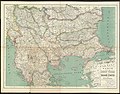
 Map of Bulgaria and Eastern Rumelia in 1882.jpg 1,420 × 1,012; 257 KB
-
 PrincipadoDeBulgariaDesde1885bulgariapastpres00samuuoft 0136.png 730 × 451; 600 KB
-
 Special Karte von Bulgarien und Ost-Rumelien - von F. Handtke - btv1b53022938r.jpg 10,569 × 8,275; 20.57 MB

_p008_THE_HISTORICAL_LANDSCAPES_OF_THE_CENTRAL_OTTOMAN_EMPIRE.jpg)
_p195_TURKEY_IN_EUROPE,_BEFORE_THE_WAR_WITH_RUSSIA.jpg)
_p224_TURKEY_IN_EUROPE,_AFTER_THE_WAR_WITH_RUSSIA.jpg)
.jpg)


