Category:1872 maps of Canada
Jump to navigation
Jump to search
| ← 1870 1871 1872 1873 1874 1875 1876 1877 1878 1879 → |
English: Maps of Canada from 1872 or related to Canada in 1872
Français : Les cartes du Canada de 1872 ou se rapportant au Canada en 1872
Media in category "1872 maps of Canada"
The following 6 files are in this category, out of 6 total.
-
 308 of 'Other Countries ... With maps and illustrations' (11061281074).jpg 1,411 × 401; 110 KB
-
 Canada 1872 Federal Election.svg 1,084 × 920; 357 KB
-

-

-
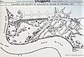 Location and Identity of Buildings in Village of Winnipeg 1872 (1922).jpg 2,746 × 1,871; 7.23 MB
-


.jpg)
.jpg)
.jpg)
.jpg)
.jpg)