Category:1860s maps of the world
Jump to navigation
Jump to search
| 19th-century maps of the world: ← 1800s 1810s 1820s 1830s 1840s 1850s 1860s 1870s 1880s 1890s → |
English: This category is supposed to hold world maps created in the 1860s.
Subcategories
This category has the following 2 subcategories, out of 2 total.
- 1862 maps of the world (12 F)
- 1865 maps of the world (2 F)
Media in category "1860s maps of the world"
The following 48 files are in this category, out of 48 total.
-
1860 Black Map of the World - Geographicus - TheWorld-black-1860.jpg 3,500 × 2,164; 1.88 MB
-
MAP026 L.JPG 2,484 × 2,042; 1.03 MB
-
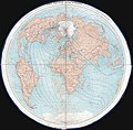
1860 James Polar Projection of the Globe, Arctic - Atlantic Projection.jpg 4,000 × 3,938; 2.3 MB
-
1860 map of the world highlighting the temperate zone.jpg 9,501 × 5,152; 7.11 MB
-
1861 map - The pictorial missionary map of the world.tif 8,744 × 5,789; 144.84 MB
-
Mappemonde spheroidale.jpg 5,965 × 3,835; 3.58 MB
-
España 1864.jpg 2,021 × 1,550; 417 KB
-
Bouillet - Atlas universel, Carte 40.png 3,425 × 2,674; 26.21 MB
-
Bouillet - Atlas universel, Carte 41.png 3,425 × 2,674; 26.21 MB
-
1866 Johnson Map of the World in Hemispheres - Geographicus - WorldHemi-johnson-1866.jpg 5,000 × 2,820; 4.28 MB
-
Papageien Finsch.jpg 2,881 × 1,700; 3.78 MB
-
A geography for beginners - DPLA - 25f2e74de5ecf0e41a5329ccbf9af71f (page 9).jpg 2,743 × 2,321; 847 KB
-
Ca. 1860 map - Mappemonde ethnographique - par L. Dussieux, d'apres Berghaus, Prichard, etc.tif 5,312 × 3,977; 60.46 MB
-
Carte du monde de 1860.JPG 3,643 × 2,994; 4.02 MB
-
Connaissances geographiques.jpg 5,965 × 3,835; 3.53 MB
-
Le Tour du monde-10-p290.jpg 1,902 × 1,746; 845 KB
-
Le Tour du monde-10-p318.jpg 1,908 × 1,749; 926 KB
-
Orbis terrarum antiquis notus, 1861.jpg 4,994 × 3,779; 5.04 MB
-
Planisphere Babinet.jpg 8,109 × 6,303; 11.18 MB
-
The world in hemispheres. With other projections etc etc NYPL1510790.tiff 6,298 × 5,246; 95.19 MB


