Category:1860s maps of the Levant
Jump to navigation
Jump to search
English: This category is intended to collect old maps from the 1860s that depict the Levantine coast, i.e. the area of Cilicia, Syria and Palestine, including the areas of modern Israel and Lebanon. Compare also 19th-century maps of the Near East, which should depict larger areas, usually including Egypt, Turkey, Mesopotamia and Arabia. Old maps that are thematically intended to show the Holy Land and/or its history, should instead be sorted into Old maps of the Holy Land and its subcategories.
| 19th-century maps of the Levant: ← 1800s 1810s 1820s 1840s 1850s 1860s 1870s 1890s → |
Subcategories
This category has only the following subcategory.
P
Media in category "1860s maps of the Levant"
The following 13 files are in this category, out of 13 total.
-
 Johnston, Alexander Keith (1804-1871). Turkey in Asia, Transcaucasia. 1861 (C).jpg 1,720 × 1,417; 460 KB
-

-

-

-

-
 Garnier, F. A., Turquie, Syrie, Liban, Caucase. 1862. (C).jpg 572 × 668; 119 KB
-
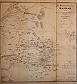 Abhandlungen der Königlichen Akademie der Wissenschaften in Berlin (1863) (16559246347).jpg 3,228 × 3,527; 1.72 MB
-
 Admiralty Chart No 2633 Syria sheet 2 Markhab to Ras En-Nakúra, Published 1863.jpg 8,140 × 12,412; 14.45 MB
-
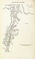
 Le Tour du monde-07-p051.jpg 960 × 1,232; 682 KB
-
 Stein, Christ. Gottfr. Dan.West-Asien. 1865 KA.jpg 906 × 1,160; 205 KB
-
 Stein, Christ. Gottfr. Dan.West-Asien. 1865 KB.jpg 906 × 643; 109 KB
-
 188 of '(Sinai and Palestine, etc.)' (11071170945).jpg 1,397 × 2,348; 540 KB
-
 Das Mittelländische Meer Und Nord-Afrika.jpg 5,652 × 4,701; 10.51 MB
.jpg)
_(16559246347).jpg)


%27_(11071170945).jpg)

._Turkey_in_Asia,_Transcaucasia._1861_(C).jpg)
._Turkey_in_Asia,_Transcaucasia._1861_(CC).jpg)
._Turkey_in_Asia,_Transcaucasia._1861_(CCB).jpg)
._Turkey_in_Asia,_Transcaucasia._1861_(CCC).jpg)
._Turkey_in_Asia,_Transcaucasia._1861_(CCD).jpg)