Category:1810s maps of the Levant
Jump to navigation
Jump to search
English: This category is intended to collect old maps from the 1810s that depict the Levantine coast, i.e. the area of Cilicia, Syria and Palestine, including the areas of modern Israel and Lebanon. Compare also 19th-century maps of the Near East, which should depict larger areas, usually including Egypt, Turkey, Mesopotamia and Arabia. Old maps that are thematically intended to show the Holy Land and/or its history, should instead be sorted into Old maps of the Holy Land and its subcategories.
| 19th-century maps of the Levant: ← 1800s 1810s 1820s 1840s 1850s 1860s 1870s 1890s → |
Media in category "1810s maps of the Levant"
The following 8 files are in this category, out of 8 total.
-
 Bowen, Frances. Turkey in Asia. 1810 (I).jpg 1,060 × 1,140; 143 KB
-
 Darton, William. Turkey in Asia. 1811 (DB).jpg 768 × 923; 186 KB
-

-
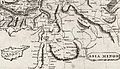 Arrowsmith, Aaron; Lewis, Samuel. Asia Minor. 1812 (F).jpg 2,461 × 1,423; 897 KB
-
 Pinkerton, John. Turkey in Asia. 1813 (FB).jpg 898 × 913; 287 KB
-
 Pinkerton, John. Turkey in Asia. 1813 (FC).jpg 467 × 593; 106 KB
-
-
 Palestine and Syria, Syria Antiqua et Palaestina.jpg 12,190 × 8,811; 16.18 MB
.jpg)
.jpg)
.jpg)
.jpg)
.jpg)
.jpg)

