Category:1860 maps of Washington, D.C.
Jump to navigation
Jump to search
States of the United States: California · Delaware · Florida · Illinois · Iowa · Kansas · Louisiana · Maryland · Massachusetts · Michigan · New Jersey · New Mexico · New York · Ohio · Pennsylvania · Utah · Virginia – Washington, D.C.
| ← 1860 1861 1863 1864 1865 1867 |
Media in category "1860 maps of Washington, D.C."
The following 10 files are in this category, out of 10 total.
-
 (Map of Washington D.C. and vicinity). LOC 88694110.jpg 3,970 × 3,796; 1.86 MB
-
 (Map of Washington D.C. and vicinity). LOC 88694110.tif 3,970 × 3,796; 43.12 MB
-
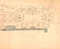
 (Maps of Saint Elizabeths Hospital, Washington D.C.) LOC 88693084.tif 10,049 × 4,611; 132.57 MB
-

-
-

-

-
 Maps of Saint Elizabeths Hospital, Washington D.C. LOC 88693084.jpg 10,049 × 4,611; 6.02 MB
-

-

._LOC_88694110.jpg)


