Category:1860 maps of California
Jump to navigation
Jump to search
States of the United States: California · Delaware · Florida · Illinois · Iowa · Kansas · Louisiana · Maryland · Michigan · New Jersey · New Mexico · New York · Ohio · Pennsylvania · Utah · Virginia – Washington, D.C.
| ← 1860 1861 1862 1864 1865 1866 1867 1868 1869 |
Media in category "1860 maps of California"
The following 4 files are in this category, out of 4 total.
-
 1860 Cal Central RR on Map of Central California.png 1,007 × 1,374; 2.17 MB
-
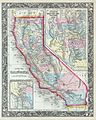 1860 Mitchell's Map of California - Geographicus - CA-m-1860.jpg 3,302 × 4,131; 3.69 MB
-
 County map of California. NYPL1510830.tiff 5,248 × 6,299; 95.24 MB
-
 Territory and military department of Utah LOC 2015591071.jpg 12,806 × 8,733; 15.9 MB


