Category:1850s maps of Albania
Jump to navigation
Jump to search
Countries of Europe: Albania · Armenia‡ · Austria · Azerbaijan‡ · Belarus · Belgium · Bosnia and Herzegovina · Bulgaria · Croatia · Cyprus‡ · Czech Republic · Denmark · Estonia · Finland · France‡ · Georgia‡ · Germany · Greece · Hungary · Iceland · Republic of Ireland · Italy · Latvia · Lithuania · Moldova · Montenegro · Netherlands‡ · Norway · Poland · Portugal‡ · Romania · Russia‡ · Serbia · Slovenia · Spain‡ · Sweden · Switzerland · Turkey‡ · Ukraine · United Kingdom
Limited recognition: Abkhazia‡
‡: partly located in Europe
Limited recognition: Abkhazia‡
‡: partly located in Europe
![](https://upload.wikimedia.org/wikipedia/commons/thumb/7/7f/Pin_Map_Vector.svg/30px-Pin_Map_Vector.svg.png)
![](https://upload.wikimedia.org/wikipedia/commons/thumb/3/36/Flag_of_Albania.svg/24px-Flag_of_Albania.svg.png)
Media in category "1850s maps of Albania"
The following 3 files are in this category, out of 3 total.
-
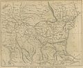
(1853) MAP OF LOWER DANUBIA.jpg 3,131 × 2,568; 3.47 MB
-
Map of Albania &ca - Lear Edward - 1851.jpg 1,047 × 1,500; 536 KB
-
Shkodër BV044856696.jpg 7,296 × 10,802; 12.84 MB