Category:1850 maps of France
Jump to navigation
Jump to search
Media in category "1850 maps of France"
The following 23 files are in this category, out of 23 total.
-
 1850 Perthes Map of France - Geographicus - France-perthes-1850.jpg 2,892 × 2,530; 2.07 MB
-

-
 Cadastre 1850 Gibet de Creuë.png 952 × 673; 762 KB
-
 Carte de France par départements - dressée par A.-H. Dufour - btv1b530835192.jpg 10,993 × 7,660; 14.58 MB
-

-

-
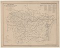
 Carte routière du département de l'Ardèche - 1850.jpg 7,841 × 9,494; 7.6 MB
-
 Carte routière du département de l'Aude - 1850.jpg 9,981 × 8,004; 10.98 MB
-
 Carte routière du département de l'Hérault.jpg 9,920 × 7,259; 9.38 MB
-
 Carte routière du Pas-de-Calais - 1850.jpg 11,200 × 9,768; 16.21 MB
-
 Carte routière et industrielle de l'arrondissement de Valenciennes - 1850.jpg 9,448 × 11,342; 13.34 MB
-
 Carte routière, administrative et démographique du département de la Saône et Loire - 1850.jpg 9,540 × 6,864; 10.17 MB
-
 Carte topographique du département de la Meurthe - 1850.jpg 7,871 × 6,547; 13.39 MB
-
-
 La Lieue de Grève vers 1850.gif 512 × 418; 7 KB
-
 Leblanc, Plan des barricades de février, 1848 - Gallica.jpg 5,830 × 4,096; 5.11 MB
-
 Nouvelle carte de l'arrondissement de Rouen - 1850.jpg 10,886 × 7,604; 10.1 MB
-
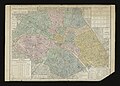
 Paris. Dessiné par Navlet; et lith. par Walter, 1850 - Gallica.jpg 9,889 × 7,807; 19.45 MB
-
 Plan de la ville de Pontivy et de ses principaux mouments 1850.jpg 994 × 778; 513 KB
-
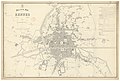 Plan de la ville de Rennes - btv1b530302232.jpg 10,413 × 7,070; 10.18 MB
-
 Railway map of France - 30 - 1850 - fr - small.svg 705 × 1,020; 5.02 MB
-
 Railway map of France - 75 - 1850 - fr - small.svg 564 × 1,020; 3.97 MB
-
 Railway map of France - 78 - 1850 - fr - small.svg 705 × 1,616; 11.64 MB

_(20213641709).jpg)


