
Category:1840s maps of Slovenia
Media in category "1840s maps of Slovenia"
The following 8 files are in this category, out of 8 total.
-
 Special-Karte des Herzogthums Krain 1843.jpg 25,952 × 20,000; 125.24 MB
-
 Herzogthum Steyermark.jpg 4,546 × 5,329; 8.03 MB
-
 Königreich Illyrien.jpg 4,509 × 5,430; 6.94 MB
-
 General-Karte des Herzogthums Steyermark 1842 (II).jpg 10,104 × 10,180; 88.61 MB
-

-
 General-Karte des Königreichs Illyrien nebst dem Königlich Ungarischen Littorale 1843.jpg 10,338 × 13,256; 113.39 MB
-
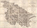
 Special-Karte des Herzogthums Krain 1843 (part 6).jpg 5,000 × 3,836; 9.23 MB
-
 Spezial Karte des Marburger Kreises im Herzogthum Steyermark 1840.jpg 4,155 × 3,020; 2.06 MB


.jpg)
.jpg)

.jpg)
