Category:1840s maps of Norway
Jump to navigation
Jump to search
Subcategories
This category has the following 10 subcategories, out of 10 total.
- 1840 maps of Norway (1 F)
- 1841 maps of Norway (5 F)
- 1842 maps of Norway (6 F)
- 1843 maps of Norway (10 F)
- 1844 maps of Norway (8 F)
- 1845 maps of Norway (20 F)
- 1846 maps of Norway (8 F)
- 1847 maps of Norway (10 F)
- 1848 maps of Norway (6 F)
- 1849 maps of Norway (6 F)
Media in category "1840s maps of Norway"
The following 12 files are in this category, out of 12 total.
-
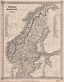 Barclay's Dictionary Sweden and Norway.jpg 4,715 × 6,051; 18.31 MB
-

-
-

-

-

-

-

-

-

-

-
 Veikart over Norge (14553369241).jpg 1,834 × 2,048; 705 KB


.jpg)