Category:1834 maps of the United Kingdom
Jump to navigation
Jump to search
Countries of Europe: France‡ · Germany · Norway · Russia‡ · Spain‡ · United Kingdom
‡: partly located in Europe
‡: partly located in Europe
Media in category "1834 maps of the United Kingdom"
The following 3 files are in this category, out of 3 total.
-
 1834 map of Edinburgh.jpg 9,612 × 7,709; 18.57 MB
-
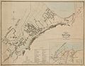 Bangor town plan 4669575.jpg 3,607 × 2,810; 4.55 MB
-
 Ordnance Survey Drawings - Machynlleth (OSD 337).jpg 3,116 × 4,000; 3.36 MB


.jpg)