Category:1832 maps of the United Kingdom
Jump to navigation
Jump to search
Media in category "1832 maps of the United Kingdom"
The following 7 files are in this category, out of 7 total.
-

-
 Gloucestershire 1832 Map.png 1,999 × 2,075; 731 KB
-
 Ordnance Survey Drawings - Powys (OSD 332).jpg 5,722 × 3,881; 4.17 MB
-
 Ordnance Survey Drawings - Sandon (OSD 333).jpg 5,594 × 4,197; 3.06 MB
-
 SDUK MAP Environment of London 1832.jpg 4,680 × 4,000; 7.51 MB
-
 Warwickshire Administrative 1832.png 1,425 × 2,000; 476 KB
-
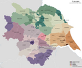 Yorkshire Administrative Map 1832.png 2,410 × 2,000; 690 KB


.jpg)
.jpg)


