Category:1830s maps of Ireland
Jump to navigation
Jump to search
Countries of Europe: Albania · Armenia‡ · Azerbaijan‡ · Belgium · Bulgaria · Cyprus‡ · Czech Republic · Denmark · Estonia · Finland · France‡ · Georgia‡ · Germany · Greece · Hungary · Republic of Ireland · Italy · Latvia · Lithuania · Netherlands‡ · Norway · Poland · Portugal‡ · Romania · Russia‡ · Slovenia · Spain‡ · Sweden · Switzerland · Turkey‡ · Ukraine · United Kingdom
Limited recognition: Abkhazia‡
‡: partly located in Europe
Limited recognition: Abkhazia‡
‡: partly located in Europe
Media in category "1830s maps of Ireland"
The following 12 files are in this category, out of 12 total.
-

-
 1832 Irish Postal Circulation Map.jpg 1,497 × 1,966; 710 KB
-

-

-
 1836 map of Dublin.jpg 9,695 × 7,545; 15.14 MB
-
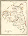 1837Londonderry.jpg 1,156 × 1,496; 167 KB
-
 The Useful Knowledge Society's Family Atlas, MAP OF IRELAND - PART 1.jpg 8,028 × 5,383; 8.35 MB
-
 The Useful Knowledge Society's Family Atlas, MAP OF IRELAND - PART 2.jpg 8,038 × 5,226; 7.83 MB
-
 Harness Ireland Railroad Map 1838.png 2,000 × 2,514; 7.59 MB
-
-
 Ireland - btv1b53119500s.jpg 7,754 × 9,976; 13.96 MB
-
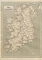
 Ireland 1831.jpg 5,215 × 7,717; 5.13 MB
%27_(11012311825).jpg)

%27_(11012152725).jpg)
)%27_(11010001473).jpg)


.jpg)

