Category:1814 maps
Jump to navigation
Jump to search
| ← · 1810 · 1811 · 1812 · 1813 · 1814 · 1815 · 1816 · 1817 · 1818 · 1819 · → |
Deutsch: Karten mit Bezug zum Jahr 1814
English: Maps related to the year 1814
Español: Mapas relativos al año 1814
Français : Cartes concernant l’an 1814
Русский: Карты 1814 года
Subcategories
This category has the following 8 subcategories, out of 8 total.
Media in category "1814 maps"
The following 134 files are in this category, out of 134 total.
-
"We the subscribers ..." (copy) NYPL1404002.tiff 4,384 × 6,299; 79.02 MB
-
1814 Thomson Map of Mexico and Texas - Geographicus - SpanishNorthAmerica-thomson-1814.jpg 5,000 × 4,107; 6.03 MB
-
1814 Thomson Map of the Atlantic Ocean - Geographicus - Atlantic-t-1814.jpg 5,000 × 3,990; 2.94 MB
-
1814 Thomson Map of the English Channel - Geographicus - BritishChannel-thomson-1814.jpg 5,000 × 4,029; 4.94 MB
-
1814 Thomson Map of the West Indies ^ Central America - Geographicus - WestIndies-t-1814.jpg 5,000 × 4,215; 4.41 MB
-
CASTELNAU(1827) p3.039 PLAN DE LA VILLE D' ODESSA EN 1814.jpg 4,367 × 3,431; 8.94 MB
-
PLAN OF MEKKA (1814).jpg 2,282 × 3,076; 3.77 MB
-
THE PLAN OF ARAFAT (1814).jpg 2,302 × 3,048; 2.66 MB
-
PLAN OF WADY MUNA (1814).jpg 2,300 × 3,044; 2.59 MB
-
PLAN OF MEDINA (1814).jpg 2,306 × 3,100; 2.66 MB
-
A chart of the West Indies, from the latest marine journals and surveys. NYPL1404013.tiff 6,299 × 5,248; 94.6 MB
-
A correct map of Virginia. NYPL433675.tiff 6,300 × 5,248; 94.61 MB
-
A map of George Town with the additions - 1814 LOC 88693289.jpg 12,808 × 9,240; 16.72 MB
-
A map of George Town with the additions - 1814 LOC 88693289.tif 12,808 × 9,240; 338.59 MB
-
A map of Ireland according to the best authorities. NYPL1404023.tiff 6,299 × 5,248; 94.6 MB
-
A map of the French part of St. Domingo. NYPL1404014.tiff 6,299 × 5,248; 94.6 MB
-
A new map of Virginia with Maryland, Delaware & v. LOC 2008621667.jpg 8,836 × 6,307; 12.42 MB
-
A new map of Virginia with Maryland, Delaware & v. LOC 2008621667.tif 8,836 × 6,307; 159.44 MB
-
Battle of Tehoo(pca). LOC 2012588006.jpg 3,159 × 2,473; 818 KB
-
Battle of Tehoo(pca). LOC 2012588006.tif 3,159 × 2,473; 22.35 MB
-
Cadastral map of "Peter's square," Georgetown, Washington D.C.. LOC 88693297.jpg 5,163 × 6,354; 3.07 MB
-
Cadastral map of "Peter's square," Georgetown, Washington D.C.. LOC 88693297.tif 5,163 × 6,354; 93.86 MB
-
Cadastral map of "Peter's square," Georgetown, Washington D.C.. LOC 88693298.jpg 5,138 × 6,343; 3.25 MB
-
Cadastral map of "Peter's square," Georgetown, Washington D.C.. LOC 88693298.tif 5,138 × 6,343; 93.24 MB
-
Canaan illustrating the books of Joshua & Judges (FL37119234 3896470).jpg 2,473 × 3,211; 5.27 MB
-
Carey's general atlas ... (Title page) NYPL1403994.tiff 4,360 × 6,299; 78.59 MB
-
Carte de la campagne de Paris (FL35076874 2585529).jpg 9,668 × 12,199; 157.98 MB
-
Chart of the coast of China to the eastward of the great Ladrone LOC 2007629467.jpg 8,843 × 6,402; 6.72 MB
-
Chart of the coast of China to the eastward of the great Ladrone LOC 2007629467.tif 8,843 × 6,402; 161.97 MB
-
Chili and part of the Viceroyalty of La Plata. NYPL1404017.tiff 4,688 × 6,299; 84.51 MB
-
China divided into its great provinces according to the best authorities LOC 2006629385.jpg 8,074 × 6,570; 7.96 MB
-
China divided into its great provinces according to the best authorities LOC 2006629385.tif 8,074 × 6,570; 151.77 MB
-
China, divided into its great provinces. According to the best authorities. NYPL1404032.tiff 6,299 × 5,248; 94.6 MB
-
Connecticut, from the best authorities. NYPL1404000.tiff 6,299 × 5,248; 94.6 MB
-
Delaware from the best authorities. LOC 2018590121.jpg 3,069 × 5,187; 2.38 MB
-
Delaware from the best authorities. LOC 2018590121.tif 3,069 × 5,187; 45.54 MB
-
Delaware LOC 2018590119.jpg 2,136 × 2,469; 692 KB
-
Delaware LOC 2018590119.tif 2,136 × 2,469; 15.09 MB
-
Delaware, from the best authorities. NYPL433674.tiff 4,584 × 6,299; 82.63 MB
-
Europe. NYPL1404019.tiff 6,299 × 5,248; 94.6 MB
-
Fort Green, New York. LOC 2012588013.jpg 4,477 × 5,327; 2.83 MB
-
Fort Green, New York. LOC 2012588013.tif 4,477 × 5,327; 68.23 MB
-
Fort McHenry National Monument and Historic Shrine, Maryland LOC 91684469.jpg 10,112 × 7,066; 10.39 MB
-
Fort McHenry National Monument and Historic Shrine, Maryland LOC 91684469.tif 10,112 × 7,066; 204.42 MB
-
Fort McHenry National Monument and Historic Shrine, Maryland LOC 93680063.jpg 10,040 × 7,064; 11.98 MB
-
Fort McHenry National Monument and Historic Shrine, Maryland LOC 93680063.tif 10,040 × 7,064; 202.91 MB
-
Fort McHenry National Monument and Historic Shrine, Maryland LOC 94684116.jpg 10,080 × 7,062; 11.05 MB
-
Fort McHenry National Monument and Historic Shrine, Maryland LOC 94684116.tif 10,080 × 7,062; 203.66 MB
-
Fort McHenry National Monument and Historic Shrine, Maryland LOC 98688137.jpg 10,075 × 7,047; 10.65 MB
-
Fort McHenry National Monument and Historic Shrine, Maryland LOC 98688137.tif 10,075 × 7,047; 203.13 MB
-
GrundrißPetersberg 1814.jpg 1,612 × 2,257; 1.28 MB
-
HMS Aboukir RMG X0078.tiff 4,800 × 3,169; 43.52 MB
-
Holland or the Seven United Provinces, and the Netherlands. NYPL1404024.tiff 5,248 × 6,299; 94.6 MB
-
Italy, and Sardinia, from the best authorities. NYPL1404028.tiff 6,300 × 5,248; 94.61 MB
-
James Playfair, Palestine and Syria (FL199985732 2368880).jpg 5,028 × 8,012; 17.41 MB
-
John Thomson, Arabia, Egypt, Abyssinia, Red Sea &c (FL35865414 2492239).jpg 15,803 × 12,921; 290.99 MB
-
Kentucky. NYPL1404003.tiff 6,299 × 5,248; 94.6 MB
-
Küstrin und Umgebung etwa 1814.jpg 710 × 520; 73 KB
-
Lewis and Clark Middle Missouri BigSioux James.jpg 1,160 × 1,050; 1.21 MB
-
Lewis and Clark track map published 1814 LoC.jpg 8,784 × 4,032; 8.71 MB
-
Manhattanville forts showing Blockhouse 1.jpg 2,798 × 1,801; 1.5 MB
-
Manhattanville forts.jpg 2,798 × 5,144; 3.36 MB
-
Manuscript plan of the Battle of Plattsburgh, New York. LOC 2005626081.jpg 7,908 × 8,904; 5.31 MB
-
Manuscript plan of the Battle of Plattsburgh, New York. LOC 2005626081.tif 7,908 × 8,904; 201.45 MB
-
Neuester Grundriss der Stadt Leipzig. Veranstaltet von Georg Voss. 1814.jpg 5,512 × 3,849; 6.34 MB
-
North Carolina. LOC 99446176.jpg 6,262 × 4,861; 5.06 MB
-
North Carolina. LOC 99446176.tif 6,262 × 4,861; 87.09 MB
-
Maryland (NYPL b15384225-434453).tiff 4,576 × 5,467; 71.58 MB
-
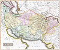
Persia 1814.jpg 2,931 × 2,448; 1.6 MB
-
Plan for Portland Place and Regent's Circus, 1814.jpg 1,800 × 1,288; 600 KB
-
Plan of bend and breast works of Tohopeka, the battle of the 27th March 1814. LOC 2007629222.tif 5,045 × 4,093; 59.08 MB
-
Plan of the Fort at Baton Rouge 1814 Lafon.jpg 640 × 402; 91 KB
-
Plano del Puerto de Apra cituado a la parte occl. de la Ysla do Guahan LOC 91683668.jpg 9,085 × 6,419; 4.17 MB
-
Plano del Puerto de Apra cituado a la parte occl. de la Ysla do Guahan LOC 91683668.tif 9,085 × 6,419; 166.85 MB
-
Playfair, Principal. Map of the World According to Strabo. 1814 A.jpg 7,523 × 4,724; 4.33 MB
-
Playfair, Principal. Map of the World According to Strabo. 1814 B.jpg 7,071 × 4,328; 4.1 MB
-
Playfair, Principal. Map of the World According to Strabo. 1814 CC.jpg 708 × 977; 111 KB
-
Playfair, Principal. Map of the World According to Strabo. 1814.jpg 8,730 × 6,463; 6.99 MB
-
Rough plan of the defences of the harbour of Annapolis in Maryland LOC 2009584278.tif 16,210 × 10,091; 467.99 MB
-
Samuel John Neele, Poland (FL35476959 2572225).jpg 18,960 × 13,357; 341.48 MB
-
Scotland with the principal roads, from the best authorities. NYPL1404021.tiff 6,299 × 5,248; 94.6 MB
-
Switzerland, according to the best authorities. NYPL1404029.tiff 6,299 × 4,784; 86.23 MB
-
The Maldiva Islands-Captain Horsburgh-1814.png 714 × 1,040; 764 KB
-
The State of South Carolina, from the bests authorities. NYPL1404004.tiff 6,299 × 5,248; 94.6 MB
-
The State of Tennessee. NYPL1403996.tiff 6,299 × 5,248; 94.59 MB
-
Theil von Krain partia de la Carniole 1814.jpg 2,604 × 2,012; 754 KB
-
Thiel von Krain partie de la Carniole 1814.jpg 3,348 × 2,933; 1.6 MB
-
Vermont, from actual survey. NYPL1403998.tiff 6,299 × 5,248; 94.6 MB
-
Winterthur1292.jpg 454 × 472; 87 KB


