Category:1812 maps
Jump to navigation
Jump to search
| ← · 1810 · 1811 · 1812 · 1813 · 1814 · 1815 · 1816 · 1817 · 1818 · 1819 · → |
Deutsch: Karten mit Bezug zum Jahr 1812
English: Maps related to the year 1812
Español: Mapas relativos al año 1812
Français : Cartes concernant l’an 1812
Русский: Карты 1812 года
Subcategories
This category has the following 7 subcategories, out of 7 total.
Media in category "1812 maps"
The following 71 files are in this category, out of 71 total.
-
 CURRIE(1812) Guide at the Giant's Causeway, Map.jpg 4,675 × 2,542; 2.94 MB
-
 (1812) MAP OF THE STRAIT OF MADURA, SUNDA ISLANDS.jpg 3,283 × 2,327; 3.33 MB
-
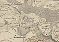
 1812 Kartierung Lambach 2.jpg 1,293 × 904; 321 KB
-
 1812 Kartierung Lambach.jpg 996 × 710; 199 KB
-
-
-

-
 Acções na região de Salamanca 21-27Jun1812.png 805 × 773; 93 KB
-
 Adventures of Johnny Newcome RMG F3069.tiff 3,800 × 2,486; 27.03 MB
-
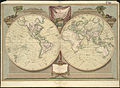
 Arrowsmith's map of the world (1812).jpg 6,410 × 3,530; 10.54 MB
-
 Assheton delin. Hewitt Sc, Plan of the city of Jerusalem (FL6878512 2368129).jpg 2,872 × 2,150; 3.02 MB
-
-
 Branche Pont St Maur cadastre 1812.jpg 7,934 × 5,500; 1.88 MB
-
 Carte des routes royales et départementales du Nord - 1812.jpg 16,152 × 6,318; 11.67 MB
-

-
 Conrad Malte-Brun, Geographie des Hebreux (FL199398294 2368751).jpg 4,220 × 5,768; 11.29 MB
-
 Conrad Malte-Brun, Palestine (FL199398036 2368752).jpg 5,440 × 4,064; 13.53 MB
-
 Cádiz en 1812.jpg 4,928 × 3,488; 1.89 MB
-
 De l'Allemagne politique en 1812 (FL189885417 2563491).jpg 16,261 × 12,227; 271.27 MB
-
-
 Erlangen Gegend um Erlang 1812 001.jpg 1,088 × 746; 319 KB
-
 Grevskapsmålinger 9D1 19, Vestfold, 1812.jpg 6,857 × 6,876; 11.35 MB
-
 Grevskapsmålinger 9D1 21a, Vestfold, 1812.jpg 6,942 × 6,921; 11.39 MB
-
 Grevskapsmålinger 9D1 23b, Vestfold, 1812.jpg 6,830 × 6,901; 8.31 MB
-

-
-
 Jiang hai quan tu. LOC gm71005059.jpg 17,110 × 9,961; 16.96 MB
-
 Jiang hai quan tu. LOC gm71005059.tif 17,110 × 9,961; 487.61 MB
-
 John Pinkerton, La Plata (FL13729749 2534860).jpg 9,108 × 12,844; 166.46 MB
-
 Kentucky (4578769839).jpg 4,792 × 3,020; 6.15 MB
-
 Mappe-Mondes sur Diverses Projections.jpg 4,319 × 3,012; 4.33 MB
-
-
 Mark Thomson, Map of Palestine or Judea (FL27935978 2370058).jpg 5,828 × 7,065; 63.25 MB
-
 MeredithGoldküste1812 300dpi.jpg 3,088 × 2,476; 904 KB
-
 New York - drawn by S. Lewis; Tanner, sc. NYPL435010.tiff 4,688 × 4,729; 63.43 MB
-
 Plan de l'île de Caprée (33710771484).jpg 4,709 × 4,824; 12.53 MB
-
 Plan du port de Cadix.jpg 550 × 320; 93 KB
-
-

-
 Plan étangs et rigoles de Versailles (1812).jpg 1,208 × 874; 207 KB
-
 Plano de madrid 1812.jpg 800 × 640; 253 KB
-
 Provinces Illyriennes Servie et Bosnie 1812.jpg 8,297 × 6,080; 5.91 MB
-
 Siege of Cuidad Rodrigo RMG K1078.jpg 1,280 × 1,035; 1,023 KB
-
 SitiodeCadiz.jpg 900 × 630; 169 KB
-
 Sketch of the country between the Coa & Sierra de Gata LOC 2010589570.jpg 8,691 × 6,764; 6.21 MB
-
 Sketch of the country between the Coa & Sierra de Gata LOC 2010589570.tif 8,691 × 6,764; 168.19 MB
-
-

-
-

-
-

-

-

-

-

-

-

-

-
-
-

-

-

-
-

-

-

-
-

-
 Worcester County ; Essex County (4583424679).jpg 1,407 × 2,000; 3.25 MB
_Guide_at_the_Giant%27s_Causeway,_Map.jpg)
_MAP_OF_THE_STRAIT_OF_MADURA,_SUNDA_ISLANDS.jpg)


.jpg)
.jpg)

.jpg)
.jpg)

.jpg)
.jpg)
.jpg)

.jpg)
.jpg)


.jpg)
.jpg)

.jpg)
.jpg)


.jpg)

.jpg)


.jpg)


._LOC_2018588067.jpg)
.jpg)
.jpg)
.jpg)
.jpg)
.jpg)
.jpg)
.jpg)
.jpg)
.jpg)
.jpg)
.jpg)
.jpg)
.jpg)
.jpg)
.jpg)
.jpg)
.jpg)
.jpg)


.jpg)