Category:1810 maps of the United Kingdom
Jump to navigation
Jump to search
Media in category "1810 maps of the United Kingdom"
The following 11 files are in this category, out of 11 total.
-

-

-
 Londres en 1810.png 5,130 × 3,075; 1.86 MB
-
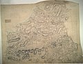
 Ordnance Survey Drawings - Bedminster (OSD 48).jpg 4,000 × 3,089; 4.45 MB
-
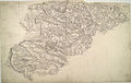
 Ordnance Survey Drawings - Cardigan, Cardigan (Sir Ceredigeon) (OSD 185).jpg 4,000 × 3,062; 5.02 MB
-
 Ordnance Survey Drawings - Chiddingfold (OSD 86).jpg 4,000 × 2,701; 4.61 MB
-
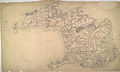 Ordnance Survey Drawings - Haverfordwest, Pembrokeshire (Sir Benfro) (OSD 183).jpg 4,000 × 2,404; 2.6 MB
-
 Ordnance Survey Drawings - Littleport, Cambridgeshire (OSD 250).jpg 2,993 × 4,000; 2.74 MB
-
 Ordnance Survey Drawings - Luton (OSD 148).jpg 4,000 × 2,534; 3.24 MB
-
 Ordnance Survey Drawings - Ockley (OSD 90).jpg 4,000 × 3,969; 7.07 MB
-
 Ordnance Survey Drawings - St. Columb Major, Cornwall (OSD 7).jpg 5,562 × 4,110; 3.76 MB


.jpg)
_(OSD_185).jpg)
.jpg)
_(OSD_183).jpg)
.jpg)
.jpg)
.jpg)
.jpg)