Category:17th-century maps of Martinique
Jump to navigation
Jump to search
Countries of North America: The Bahamas · Barbados · Canada · Costa Rica · Cuba · Guatemala · Honduras · Jamaica · Mexico · Panama · Saint Kitts and Nevis · Trinidad and Tobago‡ · United States of America‡
Other territories: Bermuda · Greenland · Guadeloupe · Martinique · Puerto Rico
‡: partly located in North America
Other territories: Bermuda · Greenland · Guadeloupe · Martinique · Puerto Rico
‡: partly located in North America
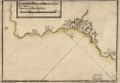
Media in category "17th-century maps of Martinique"
The following 20 files are in this category, out of 20 total.
-
 Atlas Van der Hagen-KW1049B13 085-INSULA MATANINO Vulgo MARTANICO.jpeg 5,500 × 4,529; 3.24 MB
-
 Fuerte de San Pedro y su rada en la Ysla de la Martinica. LOC 90683862.jpg 4,044 × 2,802; 1.13 MB
-
 Fuerte de San Pedro y su rada en la Ysla de la Martinica. LOC 90683862.tif 4,044 × 2,802; 32.42 MB
-
 Fuerte de San Pedro y su rada en la Ysla de Martinica. LOC 90683863.jpg 4,076 × 2,824; 1.14 MB
-
 Fuerte de San Pedro y su rada en la Ysla de Martinica. LOC 90683863.tif 4,076 × 2,824; 32.93 MB
-
 Fuerte de Sn. Pedro y su rada en la Ysla de Martinica. LOC 90683864.jpg 4,358 × 2,978; 1.11 MB
-
 Fuerte de Sn. Pedro y su rada en la Ysla de Martinica. LOC 90683864.tif 4,358 × 2,978; 37.13 MB
-

-

-

-

-

-

-

-

-
 Isle de Cayenne & Isle de Saint-Christophe,1667.png 2,840 × 3,928; 8.19 MB
-
 La Granada ; Fuerte de San Pedro y su rada en la Ysla de Martinica. LOC 90683865.jpg 4,523 × 5,780; 2.46 MB
-
 La Granada ; Fuerte de San Pedro y su rada en la Ysla de Martinica. LOC 90683865.tif 4,523 × 5,780; 74.8 MB
-

-
 Plan de la va. y Fuerte Rl. de la Isla Martinica. LOC 90683860.tif 4,493 × 5,872; 75.48 MB


_del_oeste_de_la_dha._en_la_latitu._de_14%E2%81%B0_y_36%E2%81%B0%E2%81%B0_norte_y_en_376%E2%81%B0_y_14%E2%81%B0%E2%81%B0,_meridiano_de_Tenerife._LCCN_90683858.png)
_del_oeste_de_la_dha._en_la_latitu._de_14%E2%81%B0_y_36%E2%81%B0%E2%81%B0_norte_y_en_376%E2%81%B0_y_14%E2%81%B0%E2%81%B0,_meridiano_de_Tenerife._LOC_90683858.jpg)
_de_longitud_..._LOC_90683859.jpg)
_-_o%C3%B9_l%27on_verra_l%27establissement_des_colonies_fran%C3%A7oises,_dans_ces_isles;_leurs_(20619181412).jpg)


.jpg)