Category:17th-century maps of Panama
Jump to navigation
Jump to search
Subcategories
This category has only the following subcategory.
Media in category "17th-century maps of Panama"
The following 14 files are in this category, out of 14 total.
-
 1632 Cardona Descripcion Indias (77).jpg 3,184 × 2,165; 611 KB
-
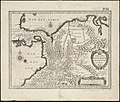 Terra firma et novum regnum Granatense et Popayan (4586556435).jpg 2,000 × 1,697; 3.33 MB
-
 Print, book-illustration, map (BM 1972,U.58.12).jpg 2,500 × 1,606; 1.05 MB
-
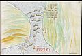
 Map of the Isthmus of Darien and Panama.jpg 1,264 × 917; 981 KB
-
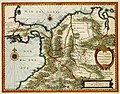
 Terra Firma et Novum Regnum Granatense et Popayan - CBT 6621102.jpg 5,531 × 4,370; 7.05 MB
-
 A new map of the isthmus of Darien - btv1b5970801r.jpg 5,848 × 3,632; 3.02 MB
-
-

-
 Darien.jpg 300 × 225; 8 KB
-

-
 Perfil Costanero Occidental de las Audiencias de Panamá, Nueva Granada, Quito y Lima - AHG.jpg 2,964 × 4,470; 14.16 MB
-
 Punta Mariato and Punta Mala RMG F1451.tiff 6,757 × 5,220; 100.91 MB
-
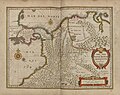 Terra Firma et novum regnum Granatense et Popayan. R 2= 22. Pièce 65.jpg 8,616 × 6,856; 10.56 MB
-
 Terra Firma et novum regnum Granatense et Popayan. R 2= 22. Pièce 66.jpg 6,752 × 4,624; 6.34 MB
.jpg)
.jpg)
.jpg)


