Category:17th-century maps of Lithuania
Jump to navigation
Jump to search
Countries of Europe: Albania · Armenia‡ · Austria · Azerbaijan‡ · Belarus · Belgium · Bosnia and Herzegovina · Bulgaria · Croatia · Cyprus‡ · Czech Republic · Denmark · Estonia · Finland · France‡ · Georgia‡ · Germany · Greece · Hungary · Iceland · Republic of Ireland · Italy · Latvia · Lithuania · Luxembourg · Malta · Montenegro · Netherlands‡ · Norway · Poland · Portugal‡ · Romania · Russia‡ · Serbia · Slovakia · Slovenia · Spain‡ · Sweden · Switzerland · Turkey‡ · Ukraine · United Kingdom
Specific status: Gibraltar · Isle of Man – Limited recognition: Abkhazia‡
‡: partly located in Europe
Specific status: Gibraltar · Isle of Man – Limited recognition: Abkhazia‡
‡: partly located in Europe
Subcategories
This category has the following 8 subcategories, out of 8 total.
- 1600s maps of Lithuania (3 F)
- 1640s maps of Lithuania (6 F)
Media in category "17th-century maps of Lithuania"
The following 5 files are in this category, out of 5 total.
-
 Cartografie in Nederland, kaart van Pruisen, NG-501-44.jpg 5,122 × 4,700; 4.33 MB
-
 Lithuanie 1700.jpg 1,280 × 932; 373 KB
-
 Lukiškės (Vilnius) in the middle of the 17th century.png 770 × 626; 835 KB
-
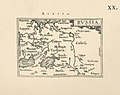 Ortelius.Russia.jpg 1,600 × 1,267; 401 KB
-
 Sarmatia Utraque Europaea et Asiatica.jpg 1,705 × 1,500; 564 KB


_in_the_middle_of_the_17th_century.png)

