Category:17th-century maps of Belgium
Jump to navigation
Jump to search
Subcategories
This category has the following 11 subcategories, out of 11 total.
- 1610s maps of Belgium (9 F)
- 1650s maps of Belgium (15 F)
- 1660s maps of Belgium (5 F)
- 1670s maps of Belgium (7 F)
- 1690s maps of Belgium (17 F)
1
Media in category "17th-century maps of Belgium"
The following 17 files are in this category, out of 17 total.
-
 Belgii veteris typus (8345414951).jpg 800 × 679; 142 KB
-
 1632 Bello Belgico Stradæ.jpg 600 × 859; 344 KB
-
 Flandria nova descriptio - CBT 6612630.jpg 5,588 × 4,738; 9.3 MB
-
 Hannonia - btv1b53213920b (1 of 2).jpg 3,646 × 2,915; 2.35 MB
-
 A new Mapp of ye Seat of the Warrs in Germany and Flanders... - btv1b52517143f (1 of 2).jpg 9,380 × 7,408; 11.32 MB
-
 Atlas Van der Hagen-KW1049B11 065-FLANDRIAE COMITATUS Accuratissima Descriptio, edita.jpeg 5,500 × 4,563; 5.22 MB
-
 Atlas Van der Hagen-KW1049B11 066-Pars FLANDRIAE occiden continens.jpeg 5,500 × 4,380; 3.74 MB
-
 B 1626 New Goos Speed.jpg 6,557 × 5,160; 2.95 MB
-

-

-

-
 Emanuel van Meteren Historie ppn 051504510 Landkaart Nederland Noord-Frankrijk MG 8638.tif 4,638 × 3,678; 48.84 MB
-
 Leo Belgicus (Dutch-Belgic Lion of the Low Countries) Famiano Strada c1647.jpg 2,810 × 4,000; 10.45 MB
-
 Map of Seventeen Provinces of Low Germanie (Zeventien Provincien der Nederlanden) 1626.jpg 10,000 × 7,836; 20.09 MB
-
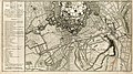 Siege de Mons. 1691.jpg 1,600 × 899; 624 KB
-
 UBBasel Map 1600-1699 Kartenslg AA 63 Germania.tiff 11,892 × 9,706, 2 pages; 330.26 MB
-
 Willem-jansz-blaeu niederlande.jpg 4,268 × 3,368; 4.32 MB
.jpg)


.jpg)
.jpg)


.jpg)
_Famiano_Strada_c1647.jpg)
_1626.jpg)

