Category:17th-century maps of Japan
Jump to navigation
Jump to search
Subcategories
This category has the following 11 subcategories, out of 11 total.
Media in category "17th-century maps of Japan"
The following 48 files are in this category, out of 48 total.
-
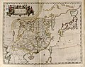
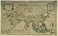
 Map of Asia (1600) North east.jpg 800 × 600; 161 KB
-
 Fen ye yu tu. LOC 2002626777-23.jpg 4,236 × 5,020; 1.92 MB
-
 Fen ye yu tu. LOC 2002626777-23.tif 4,236 × 5,020; 60.84 MB
-
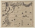
 Sea of japan in ricci world map.jpg 1,035 × 777; 1.1 MB
-
 Ortelius map of Japan engraved 25 years later.jpg 865 × 650; 137 KB
-
 Bodleian Libraries, Japoniae Insvlae descritio.jpg 1,000 × 675; 167 KB
-
 Map of Japan by Abraham Ortelius.jpeg 3,068 × 2,362; 2.3 MB
-
 Iapan-Langenen-1650.jpg 3,382 × 2,455; 6.61 MB
-

-
-
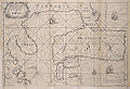
 AMH-6721-KB Map of China and Korea.jpg 2,400 × 2,187; 1,001 KB
-
 Atlas maior 1655 - vol 10 - Novus Atlas Sinensis - China - P1080382.JPG 2,560 × 1,920; 3.28 MB
-
 Iaponia Regnum.jpg 14,860 × 11,288; 23.37 MB
-
 Imperii Sinarum nova descriptio - btv1b53179352v (1 of 2).jpg 9,820 × 7,274; 8.36 MB
-
 Novvs atlas Sinensis. LOC 2002625249-1.jpg 7,768 × 6,126; 5.72 MB
-
 Novvs atlas Sinensis. LOC 2002625249-1.tif 7,768 × 6,126; 136.15 MB
-

-

-

-
 CaronMap.jpg 514 × 350; 140 KB
-

-
 Iaponia Regnvm - Atlas Maior, vol 11, map 28 - Joan Blaeu, 1667 - BL 114.h(star).11.(28).jpg 4,000 × 3,363; 1.86 MB
-
-
 The Molucca Isles; Isles of Japan; The Philippine Islands (NYPL b14428893-1503445).jpg 5,248 × 6,299; 7.1 MB
-
 1682 map of China by Giacomo Cantelli da Vignola.jpg 13,778 × 11,023; 25.59 MB
-
-
 CEM-36-NE-corner.jpg 2,560 × 1,920; 2.02 MB
-
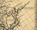
 AMH-5177-NA Map of Japan, Korea and west America.jpg 2,400 × 1,693; 455 KB
-
 Atlas Van der Hagen-KW1049B13 033-IMPERII SINARVM NOVA DESCRIPTO.jpeg 5,500 × 4,292; 3.52 MB
-
 Mea du japon1704.jpg 2,328 × 1,701; 1.78 MB
-
 Atlante Veneto Volume 2 121.jpg 10,420 × 7,186; 7.38 MB
-

-
 L'Asie divisée en ses principales régions... - par le Sr Sanson... - btv1b55000424t.jpg 11,419 × 7,126; 11.62 MB
-

-
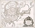
 AMH-5645-KB Map of China.jpg 2,400 × 1,875; 625 KB
-
 Atlas Van der Hagen-KW1049B13 053-IAPONIA REGNVM.jpeg 5,500 × 4,120; 2.99 MB
-
 China e Japão Mapa João Teixeira Albernaz.jpg 1,241 × 857; 291 KB
-
 Delisle - L'Asie (Ausschnitt Jesso Japan Compagnie).jpg 1,020 × 836; 685 KB
-
 Houghton PC6 C1795 646f - Cardim, Japan map.jpg 2,337 × 1,573; 1.31 MB
-
 Iaponia - btv1b530748447.jpg 7,241 × 5,541; 4.82 MB
-
 Imperii Sinarum nova descriptio - btv1b5963029q.jpg 7,232 × 5,592; 6.17 MB
-
 India quae Orientalis dicitur et insulae adiacentes - btv1b525051494 (1 of 4).jpg 9,510 × 7,598; 8.23 MB
-
 Itinerary map of the Tōkaidō Highway (14307715866).jpg 2,000 × 1,416; 1.7 MB
-
 Itinerary map of the Tōkaidō Highway (14330987955).jpg 1,129 × 2,500; 1.61 MB
-
 Large plan of Edo (14062489061).jpg 2,208 × 2,000; 1.73 MB
-
 Mallet-TerredeGesso.png 555 × 749; 731 KB
-
 Staten Island (Jan Janssonius 1652).jpeg 2,765 × 2,719; 1.5 MB
-
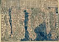
 「慶長日本総図」.jpeg 11,197 × 9,548; 9.87 MB
_North_east.jpg)


.jpg)
_balanced_(Japan).jpg)


.jpg)

_and_Surrounding_Countries_by_Italian_Missionary_%E7%BE%A9%E5%A4%A7%E5%88%A9%E4%BA%BA%E6%89%80%E7%B9%AA%E7%A6%8F%E7%88%BE%E6%91%A9%E6%B2%99%E8%87%BA%E7%81%A3%E8%88%87%E5%91%A8%E9%82%8A%E5%9C%8B%E5%AE%B6.jpg)
,_NG-501-86.jpg)
,_Japan_and_Others_by_Dutch_%E8%8D%B7%E8%98%AD%E4%BA%BA%E6%89%80%E7%B9%AA%E7%A6%8F%E7%88%BE%E6%91%A9%E6%B2%99%E8%87%BA%E7%81%A3%E8%88%87%E6%97%A5%E6%9C%AC.jpg)

.11.(12).jpg)
.11.(28).jpg)
.jpg)


.jpg)


.jpg)


.jpg)
.jpg)
.jpg)
.jpg)

.jpeg)

_and_Surrounding_Countries_by_Dutch_%E8%8D%B7%E8%98%AD%E4%BA%BA%E6%89%80%E7%B9%AA%E7%A6%8F%E7%88%BE%E6%91%A9%E6%B2%99-%E8%87%BA%E7%81%A3%E8%88%87%E9%84%B0%E5%9C%8B.jpg)