Category:17th-century maps of China
Jump to navigation
Jump to search
Countries of Asia: Afghanistan · Armenia‡ · Azerbaijan‡ · Cambodia · People's Republic of China · Cyprus‡ · Egypt‡ · Georgia‡ · India · Indonesia‡ · Iran · Iraq · Japan · Jordan · Lebanon · Mongolia · Oman · Pakistan · Philippines · Russia‡ · Singapore · Sri Lanka · Syria · Thailand · Turkey‡ · Vietnam · Yemen
Limited recognition: Abkhazia‡ · Taiwan · State of Palestine
‡: partly located in Asia
Limited recognition: Abkhazia‡ · Taiwan · State of Palestine
‡: partly located in Asia
Subcategories
This category has the following 14 subcategories, out of 14 total.
#
- 1670s maps of China (2 F)
- 1690s maps of China (6 F)
1
- 1664 Huquang, Kiangsi (etc) (7 F)
M
N
Q
- Quanzhou Fu yu di tu shuo (80 F)
X
- Xia lan zhi zhang (32 F)
Media in category "17th-century maps of China"
The following 36 files are in this category, out of 36 total.
-
 Map of Asia (1600) North east.jpg 800 × 600; 161 KB
-
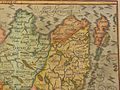
 John-Speed-The-Kingdome-of-China-1626-2544.jpg 2,024 × 1,640; 3.98 MB
-
 The Kingdome of China newly augmented by I.S. 1626.jpg 12,701 × 9,978; 29.59 MB
-
 Map of Asia (1628) North east.jpg 800 × 600; 147 KB
-
 China Map 1670 p0024.jpg 1,175 × 1,080; 339 KB
-
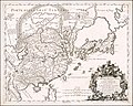
 Magnae Tartariae, Magni Mogolis Imperii, Iaponiae et Chinae nova descriptio.jpg 6,952 × 4,710; 14.67 MB
-
-
 1682 map of China by Giacomo Cantelli da Vignola.jpg 13,778 × 11,023; 25.59 MB
-

-
 Atlante Veneto Volume 2 112.jpg 7,115 × 10,592; 8.46 MB
-
 Atlante Veneto Volume 2 113.jpg 7,048 × 10,568; 7.98 MB
-
 Atlante Veneto Volume 2 114.jpg 10,567 × 7,126; 8.4 MB
-
 Atlante Veneto Volume 2 115.jpg 10,563 × 7,066; 8.15 MB
-
 Atlante Veneto Volume 2 116.jpg 10,544 × 7,056; 7.83 MB
-
 Atlante Veneto Volume 2 117.jpg 10,482 × 6,978; 8.04 MB
-
 Atlante Veneto Volume 2 118.jpg 10,455 × 7,152; 8.45 MB
-
 Atlante Veneto Volume 2 119.jpg 10,422 × 7,147; 9.41 MB
-
 Atlante Veneto Volume 2 120.jpg 10,417 × 7,264; 7.8 MB
-

-

-
 AMH-5645-KB Map of China.jpg 2,400 × 1,875; 625 KB
-

-

-
 China e Japão Mapa João Teixeira Albernaz.jpg 1,241 × 857; 291 KB
-
 China from "L'Atlas en Abrege ou Nouvelle Description du Monde,".jpg 900 × 758; 470 KB
-
 China is shown with no Korean peninsula.jpg 800 × 448; 119 KB
-
 Frederick de Wit. Maps of Asia. copper engraving. 1670s.gif 2,436 × 1,896; 4.36 MB
-
 Imperii Sinarum nova descriptio - btv1b5963029q.jpg 7,232 × 5,592; 6.17 MB
-
 Le Royaume de la Chine, divisée en provinces ou sont marqué d'une - btv1b52513475b (1 of 2).jpg 9,802 × 13,250; 13.31 MB
-
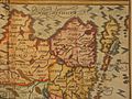
 Map of China by Abraham Ortelius.jpeg 1,579 × 1,189; 632 KB
-
 Map of Huoqing zhou, in Lijiang Prefecture, Yunnan Provonce Wellcome L0031302.jpg 3,664 × 3,028; 4.23 MB
-
 Nieuhof-Ambassade-vers-la-Chine-1665 0735.tif 4,206 × 3,540; 42.64 MB
-

-
 Quantung, e Fokien, prouincie della China.jpg 1,024 × 757; 374 KB
-
 Selden map.jpg 1,353 × 2,199; 1,008 KB
-
 UBBasel Map China 1580-1600 Kartenslg Mappe 251-134.tif 9,894 × 7,053, 2 pages; 373.52 MB
_North_east.jpg)


_North_east.jpg)


_and_Surrounding_Countries_by_Dutch_%E8%8D%B7%E8%98%AD%E4%BA%BA%E6%89%80%E7%B9%AA%E7%A6%8F%E7%88%BE%E6%91%A9%E6%B2%99%E8%87%BA%E7%81%A3%E8%88%87%E5%91%A8%E9%82%8A%E5%9C%8B%E5%AE%B6.jpg)


.jpg)


_and_Surrounding_Countries_by_Dutch_%E8%8D%B7%E8%98%AD%E4%BA%BA%E6%89%80%E7%B9%AA%E7%A6%8F%E7%88%BE%E6%91%A9%E6%B2%99-%E8%87%BA%E7%81%A3%E8%88%87%E9%84%B0%E5%9C%8B.jpg)