
Category:1790s maps of Bremen (state)
Federal states of Germany:

Subcategories
This category has only the following subcategory.
-
Media in category "1790s maps of Bremen (state)"
The following 11 files are in this category, out of 11 total.
-
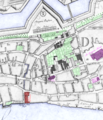
 Bremen 1796 Murtfeldt genordet zentrale Plätze.png 612 × 665; 347 KB
-
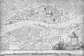 Bremen 1796 Murtfeldt.jpg 5,481 × 3,640; 16.82 MB
-
 Bremen 1796 Neues Kornhaus, Alte Jacobikirche, Ansgarii Kirche, Nicolai Witwenhs.png 1,154 × 1,343; 1.82 MB
-
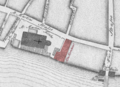 Bremen 1796 Plan - Altes Kornhaus.png 886 × 640; 562 KB
-
 Bremen 1796 Murtfeld Domshof Wall.jpg 942 × 717; 804 KB
-
 Bremen 1796 Murtfeldt Rathaus Palatium.png 942 × 1,642; 1.52 MB
-
 Bremen 1796 Rathaus Palatium Gärten.png 942 × 1,642; 1.52 MB
-
 Bremen 1798.jpg 3,655 × 2,728; 6.79 MB
-
 Bremen Territory 1798 coloured.jpg 1,912 × 1,409; 3.08 MB
-
 Niedervieland 1798.jpg 3,162 × 2,226; 4.09 MB
-
 Reichsstadt Bremen Territorium - F.A. Schrämbl, 1797.png 1,920 × 1,079; 3.78 MB


