Category:1770s maps of the Caucasus
Jump to navigation
Jump to search
Subcategories
This category has the following 4 subcategories, out of 4 total.
A
- 1770s maps of Abkhazia (1 F)
- 1770s maps of Armenia (1 F)
- 1770s maps of Azerbaijan (1 F)
G
Media in category "1770s maps of the Caucasus"
The following 12 files are in this category, out of 12 total.
-
 Andrew Dury. Present seat of war between the russians, poles and turks. 1770.jpg 5,831 × 4,456; 5.35 MB
-

-
 1771 Bonne Map of Persia ( Iran, Iraq, Afghanistan ) - Geographicus - Persia-bonne-1771.jpg 4,000 × 2,954; 3.38 MB
-
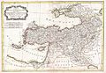 1771 Bonne Map of Turkey, Syria and Iraq - Geographicus - Turkey-bone-1771.jpg 3,500 × 2,432; 2.34 MB
-

-
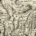
 Kist-Ingush (Кисты-Ингуши) J. Stäehlin 1771.jpg 3,688 × 1,748; 1.45 MB
-

-

-
 Caucasus map 1775 by Joseph Nicolas de l'Isle.jpg 800 × 601; 143 KB
-
 Georgia in 1775 (Carte de la Georgie).jpg 8,177 × 5,955; 13.48 MB
-
-
 Nasranova.jpg 969 × 969; 575 KB

.jpg)
_-_Geographicus_-_Persia-bonne-1771.jpg)


_J._St%C3%A4ehlin_1771.jpg)


.jpg)

