Category:1760s maps of the Caucasus
Jump to navigation
Jump to search
Subcategories
This category has the following 4 subcategories, out of 4 total.
A
- 1760s maps of Armenia (1 F)
- 1760s maps of Azerbaijan (empty)
G
Media in category "1760s maps of the Caucasus"
The following 11 files are in this category, out of 11 total.
-
 Carte de l'Arménie, Géorgie et pays voisins.tif 5,164 × 3,774; 55.78 MB
-
-

-
-

-
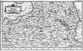
 Map - Special Collections University of Amsterdam - OTM- HB-KZL 31-08-27.tif 7,472 × 6,140; 131.26 MB
-
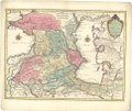 Map - Special Collections University of Amsterdam - OTM- HB-KZL 31-08-28.tif 7,908 × 6,665; 150.8 MB
-
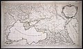
 Middle East by Robert de Vaugondy.jpg 1,000 × 987; 470 KB
-

-

-


.jpg)


