
Category:1770s maps of Ireland
Media in category "1770s maps of Ireland"
The following 9 files are in this category, out of 9 total.
-
 1771 Bonne Map of Ireland - Geographicus - Ireland-bonne-1771.jpg 4,000 × 2,896; 2.78 MB
-
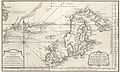 Carte reduite de la mer du nord Zusammengezogene Karte des Nordmeeres Bellin 1772.jpg 4,449 × 2,670; 1.48 MB
-

-

-
 A new map of Ireland divided into provinces, counties, &c. (20730593142).jpg 7,249 × 9,389; 12.53 MB
-
 Bernard Scale 1776 Conmaicne Rein.png 1,918 × 1,398; 1.59 MB
-
 Bernard Scale 1776 County Leitrim.png 1,238 × 1,748; 2.64 MB
-
-
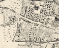
 Joseph Connor - A map of the city and suburbs of Cork - 1774.png 1,920 × 1,200; 3.32 MB


_Robert_de_Vaugondy_G%C3%A9ographe_ord(inaire)_du..._-_btv1b550137444_(040_of_183).jpg)
.jpg)
.jpg)


.png)
