Category:1765 maps
Appearance
| ← · 1760 · 1761 · 1762 · 1763 · 1764 · 1765 · 1766 · 1767 · 1768 · 1769 · → |
Deutsch: Karten mit Bezug zum Jahr 1765
English: Maps related to the year 1765
Español: Mapas relativos al año 1765
Français : Cartes concernant l’an 1765
Русский: Карты 1765 года
Subcategories
This category has the following 6 subcategories, out of 6 total.
Media in category "1765 maps"
The following 49 files are in this category, out of 49 total.
-
Anich 1765.jpg 21,672 × 9,060; 65.71 MB
-
Anlan yuan zhi Hangzhou fu xing gong dao li tu shuo. LOC 2002626740.jpg 21,427 × 2,356; 5.46 MB
-
Anlan yuan zhi Hangzhou fu xing gong dao li tu shuo. LOC 2002626740.tif 21,427 × 2,356; 144.43 MB
-
Anlanyuan zhi Jianshan qi zuo dao li tu shuo - di san zhan. LOC 85693767.jpg 13,137 × 1,695; 2.99 MB
-
Anlanyuan zhi Jianshan qi zuo dao li tu shuo - di san zhan. LOC 85693767.tif 13,137 × 1,695; 63.71 MB
-
Bod Péter térképe a honfoglalás útvonaláról.jpg 1,254 × 500; 132 KB
-
Colchester, May the- 6-th- Day- A.D.- 1765. LOC gm71000952.jpg 4,848 × 4,243; 2.04 MB
-
Colchester, May the- 6-th- Day- A.D.- 1765. LOC gm71000952.tif 4,848 × 4,243; 58.85 MB
-
Deutschlandkarte-1765-Jean de Beaurain-oben.jpg 2,000 × 1,452; 1.14 MB
-
Deutschlandkarte-1765-Jean de Beaurain-unten.jpg 2,000 × 1,368; 1,008 KB
-
Environs d'Arras - L. Denis - Gravure sur cuivre - 1765 - 001.jpg 4,419 × 3,439; 2.41 MB
-
Grenze Ämter.jpg 752 × 464; 96 KB
-
Jacques-Nicolas Bellin, Carte des variations de la boussole (FL27971628 2719547).jpg 22,240 × 15,095; 457.82 MB
-
Jean Baptiste Bourguignon d'Anville, Golfe Arabique ou Mer Rough (FL35469921 2492887).jpg 13,335 × 17,687; 253.64 MB
-
Kaart van de Kaspische zee, objectnr A 16237.jpg 7,220 × 5,912; 34.34 MB
-
Karte von dem Reiche der Koenige (FL35080812 3890185).jpg 4,200 × 5,609; 32.92 MB
-
Leksvik Frosta Kart 1765.jpg 2,890 × 2,047; 1.24 MB
-
Louis Brion de La Tour (1756-1823), L'Asie (FL27958417 2480849).jpg 8,217 × 6,806; 74.25 MB
-
Map of Chukotka and Alyaska by Daurkin.jpeg 500 × 403; 87 KB
-
Pierre Chompré, Palestine aujourd'hui Terre Sainte (FL46962402 3928659).jpg 5,253 × 3,096; 14 MB
-
Plan de Postitione del arme allier a 24. dez 1757 9106.jpg 3,032 × 4,613; 3.46 MB
-
Plan of Stoke Town and Plymouth Dock - Benjamin Donn, 1765.jpg 1,560 × 1,249; 512 KB
-
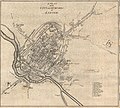
Plan of the City and Suburbs of Exeter,1765.jpg 1,850 × 1,672; 1.41 MB
-
Plan of the Town and Citadel of Plymouth, Benjamin Donn, 1765.jpg 1,612 × 1,228; 435 KB
-
Plymouth Map 1765.jpg 590 × 726; 158 KB
-
SAlcaraz historica 1765.JPG 787 × 562; 127 KB
-
Salem Mappa 1765.jpg 3,250 × 2,594; 2.09 MB
-
Tobago. LOC 74691612.jpg 7,868 × 6,210; 4.63 MB
-
Tobago. LOC 74691612.tif 7,868 × 6,210; 139.79 MB
-
VAlcudiaHistorico1765.JPG 1,064 × 335; 162 KB
-
Wuestenrot 1765.jpg 3,874 × 3,070; 2.73 MB


