Category:1760 maps of Quebec
Jump to navigation
Jump to search
Provinces and territories of Canada: Quebec ·
| ← 1760 1761 1763 1764 1767 1768 |
English: Maps of Quebec from 1760 or related to Quebec in 1760
Français : Les cartes du Quebec de 1760 ou se rapportant au Quebec en 1760
Media in category "1760 maps of Quebec"
The following 4 files are in this category, out of 4 total.
-

-
 Carte Montreal 1760.jpg 1,200 × 895; 464 KB
-
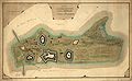 IleAuxNoix1760.jpeg 2,190 × 1,347; 534 KB
-
 Plan of the Action on the Heights of Abraham 28th. of April 1760 W.B. - btv1b10106328j.jpg 7,600 × 4,507; 3.85 MB


