Category:1759 maps of Quebec
Jump to navigation
Jump to search
Provinces and territories of Canada: Quebec ·
| ← 1751 1752 1754 1758 1759 → |
English: Maps of Quebec from 1759 or related to Quebec in 1759
Français : Les cartes du Quebec de 1759 ou se rapportant au Quebec en 1759
Subcategories
This category has only the following subcategory.
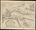
Media in category "1759 maps of Quebec"
The following 17 files are in this category, out of 17 total.
-

-
 Siège de Québec en 1759, gravure.svg 634 × 423; 7.08 MB
-
 SULTE(1882) 3.113 QUEBEC 1759.jpg 2,735 × 1,857; 2.49 MB
-

-
 A plan of Quebec (30095634846).jpg 1,920 × 1,257; 1.12 MB
-
 A plan of Quebec (4231159347).jpg 2,000 × 1,321; 2.98 MB
-
 A plan of Quebec, metropolis of Canada in North America. LOC 2017593660.jpg 4,025 × 2,771; 1.33 MB
-
 A plan of Quebec, metropolis of Canada in North America. LOC 2017593660.tif 4,025 × 2,771; 31.91 MB
-
 A plan of Quebec. LOC 2017593661.jpg 9,220 × 6,407; 8.55 MB
-
 A plan of Quebec. LOC 2017593661.tif 9,220 × 6,407; 169.01 MB
-
 A plan of Quebec. LOC 2017593662.jpg 4,883 × 3,920; 2.82 MB
-
 A plan of Quebec. LOC 2017593662.tif 4,883 × 3,920; 54.76 MB
-

-
-

-
 The history of the late war in North-America Fleuron T122589-2.png 5,758 × 1,043; 303 KB
-
 TroisRivieres1759.png 413 × 471; 427 KB
.jpg)

_3.113_QUEBEC_1759.jpg)
%27_(11112169364).jpg)
.jpg)
.jpg)


.jpg)
.jpg)
_shewing_the_principal_encampments_and_works_of_the_British_Army_commanded_by_Maior_General_LOC_2005630163.jpg)
