Category:1750s maps of Central Asia
Jump to navigation
Jump to search
English: This category is intended to collect maps from the 1750s, showing Central Asia. (Note: This is preferred over subdividing the region according to current/modern borders, unless the map title or prominent labels name a specific modern or past country.)
| 18th-century maps of Central Asia: 1720s 1730s 1740s 1750s 1770s 1780s 1790s → |
Media in category "1750s maps of Central Asia"
The following 9 files are in this category, out of 9 total.
-
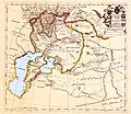
 Ca. 1750 manuscript map of the Caspian Sea and the surroundings.jpg 9,543 × 7,997; 13.88 MB
-

-

-

-

-
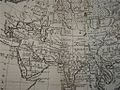 Asia1752d1.jpg 1,024 × 767; 177 KB
-
 Tartary1752.jpg 461 × 325; 78 KB
-
 1755 жылғы ландскарта.jpg 2,550 × 2,215; 4.07 MB
-
 1759 жылы жарық көрген француз картасы. Фрагмент.jpg 2,809 × 1,537; 901 KB

,_1766_little_bocharia_1752_north_west.jpg)
,_1766_little_bocharia_1752.jpg)
,_1766_persia_1752_north_est.jpg)
,_1766_persia_1752_north_west.jpg)


