Category:1744 maps
Jump to navigation
Jump to search
| ← · 1740 · 1741 · 1742 · 1743 · 1744 · 1745 · 1746 · 1747 · 1748 · 1749 · → |
Deutsch: Karten mit Bezug zum Jahr 1744
English: Maps related to the year 1744
Español: Mapas relativos al año 1744
Français : Cartes concernant l’an 1744
Русский: Карты 1744 года
Subcategories
This category has the following 8 subcategories, out of 8 total.
Media in category "1744 maps"
The following 48 files are in this category, out of 48 total.
-
 1730 Homann Map of Denmark - Geographicus - RegniDaniae-homann-1730.jpg 5,000 × 4,325; 7.74 MB
-
 1744 Delisle-Homann.jpg 1,943 × 2,489; 2.82 MB
-
 1744 Wren Map of London, England - Geographicus - London-wren-1744.jpg 5,000 × 3,496; 4.43 MB
-

-
-

-
-
 Carte des costes de la Floride Françoise, suivant les premieres découvertes (3120844840).jpg 1,508 × 2,000; 3.26 MB
-
 Carte des embouchures du Mississipi (4578758073).jpg 6,276 × 9,258; 18.13 MB
-
 Chitrow - Seekuh, Seebaer und Seeloewe (Ausschnitt aus einer Karte).jpg 2,073 × 1,200; 410 KB
-
 Conception Bay - Bellin, Nicolaus.jpg 1,276 × 811; 545 KB
-

-
 Galapagos 1744.jpg 2,357 × 3,831; 10.46 MB
-

-

-

-
 JNBellinMap1744MississippiLaBalize.jpg 600 × 403; 106 KB
-
-
 Johann Christoph Müller, Le Royaume De Boheme, divisée en Ses Douze Cercles (FL36554780 2526043).jpg 13,576 × 12,098; 234.37 MB
-
 Johann Matthias Hass - Map of Asia - 1744 (posthumous).jpg 3,060 × 2,830; 1.92 MB
-

-
-
 Map spb 1744 high.jpg 2,100 × 1,448; 741 KB
-
 Matthäus Seuttetre, Topographia Sedis Imperatorie Moscovitarum Petropolis (FL167448528 2369994).jpg 14,425 × 12,570; 219.35 MB
-
 Nieuwe kaart van America uitgegeven te Amsterdam (4071869817).jpg 2,000 × 1,588; 2.99 MB
-

-

-
 Nueva y Correcta Carta del Mar Pacifico Galapagos 1.jpg 1,164 × 514; 82 KB
-

-
 Plan of Annapolis Royal in Nova Scotia. LOC 2017585991.jpg 8,139 × 5,668; 5.38 MB
-
 Plan of Annapolis Royal in Nova Scotia. LOC 2017585991.tif 8,139 × 5,668; 131.98 MB
-
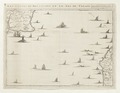
 Plan of the Attack of Camaret Bay.jpg 2,150 × 1,728; 1.97 MB
-
 Plano del El Callao en 1744 - AHG.jpg 9,211 × 6,086; 7.27 MB
-

-

-

-

-

-

-

-

-
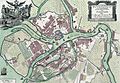
 Ravensburg Karte Rebhalden 1744 Zogenfeld Federburg.jpg 3,472 × 3,641; 8.55 MB
-
 Relacion historica del viage a la America meridional (37940442794).jpg 8,673 × 5,405; 19.82 MB
-
 Schreiber1844 0059 (cropped).jpg 495 × 660; 164 KB
-
 Schreiber1844 0059.jpg 2,831 × 2,397; 1.43 MB
-

-
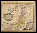
 Thomas Stackhouse, A map of Canaan divided among ey XII Tribes (FL199985934 2369067).jpg 3,648 × 5,880; 9.18 MB
-


.jpg)

.jpg)
.jpg)
.jpg)
.jpg)


_-_btv1b8596441z.jpg)
.jpg)
.jpg)

.jpg)
.jpg)
.jpg)

.jpg)
.jpg)


.jpg)


.jpg)
.jpg)


.jpg)

_gros_(blank)_ms._y_en_la_longitud_de_o_(blank)_gros_(blank)_ms._segun_el_LOC_90682890.jpg)