Category:1741 maps
Jump to navigation
Jump to search
| ← · 1740 · 1741 · 1742 · 1743 · 1744 · 1745 · 1746 · 1747 · 1748 · 1749 · → |
Deutsch: Karten mit Bezug zum Jahr 1741
English: Maps related to the year 1741
Español: Mapas relativos al año 1741
Français : Cartes concernant l’an 1741
Русский: Карты 1741 года
Subcategories
This category has the following 6 subcategories, out of 6 total.
Media in category "1741 maps"
The following 31 files are in this category, out of 31 total.
-
1741 cartagena castillo sanfelipe2.jpg 565 × 375; 89 KB
-
Abraham Ortelius, Erythraei Sive Rubri Maris Periplus (FL33131101 2490526).jpg 14,193 × 12,416; 231.03 MB
-
Heerlijkheid anholt 1741.jpg 600 × 394; 205 KB
-
Heerlijkheid borculo 1741.jpg 1,140 × 920; 831 KB
-
Heerlijkheid bredevoort 1741.jpg 1,130 × 1,010; 878 KB
-
Heerlijkheid lichtenvoorde 1741.jpg 770 × 540; 364 KB
-
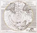
Hemisphere meridional pour voir plus distinctement les Terres Australes.png 2,770 × 2,764; 12.71 MB
-
Jan van Jagen, Nieuwe kaart van het Joodsche Land (FL33135502 3544882).jpg 10,278 × 8,399; 115.06 MB
-
Johann Simonis, ארץ ישראל (FL27823606 3855826).jpg 3,932 × 5,007; 28.96 MB
-
Josua van den Ende, Gallia vetus (FL33133765 2583508).jpg 13,549 × 10,600; 184.14 MB
-
Kwartier van Veluwe.jpg 885 × 768; 389 KB
-
Lieux de la Terre Sainte don't il est parle dans les Evangiles (FL37122115 3899041).jpg 4,203 × 2,889; 7.21 MB
-
Plano de Guayaquil en 1741, grabado por Paulus Minguet - AHG.jpg 19,179 × 13,585; 17.98 MB


