
Category:1730s maps of Paris
Subcategories
This category has the following 4 subcategories, out of 4 total.
P
Media in category "1730s maps of Paris"
The following 14 files are in this category, out of 14 total.
-

-

-
 1739 - Karte von der Gegend und Grundis der stadt Paris. 1739 - Open Data Hauts-de-Seine.jpg 7,424 × 6,344; 10.78 MB
-
 Carte topographique des environs et du plan de Paris - 1735 - btv1b8442730b.jpg 9,930 × 8,469; 22.65 MB
-
 Claude Roussel, Nouveau plan de la ville, cité et université de Paris - Gallica.jpg 16,046 × 9,891; 37.55 MB
-

-
 Dupré, Nouveau Plan de la Ville de Paris Et de Ses Faubourgs, 1738 - Gallica.jpg 10,255 × 7,483; 13.96 MB
-
 Georges-Louis Le Rouge, Environs de Paris, 1730s - Gallica.jpg 8,220 × 6,556; 11.69 MB
-
 Jean Delagrive, Carte topographique des environs et du plan de Paris, 1739 - Gallica.jpg 9,404 × 8,082; 17.84 MB
-
 Jean Delagrive, Plan de Paris, 1733 - Gallica.jpg 10,279 × 7,501; 11.81 MB
-
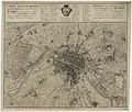
 Le Plan de Paris, ses faubourgs et ses environs - par Guillaume de L'Isle - btv1b53025386p.jpg 9,717 × 7,439; 17.97 MB
-

-
 Le plan de Paris, ses faubourgs et ses environs by Guillaume de L'Isle, 1730 - Stanford Libraries.tif 12,165 × 9,067; 105.22 MB
-


