Category:1727 maps of Africa
Jump to navigation
Jump to search
Temperate regions: North America · South America · Africa · Europe · Asia · – Polar regions: – Other regions:
| ← 1720 1721 1722 1723 1725 1726 1727 1728 1729 → |
Subcategories
This category has the following 2 subcategories, out of 2 total.
C
Media in category "1727 maps of Africa"
The following 9 files are in this category, out of 9 total.
-
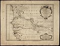
 1727 map of East Africa by Jean-Baptiste Bourguignon d'Anville.jpg 10,667 × 16,174; 30.45 MB
-
 AMH-7674-NA Map of Senegal.jpg 2,400 × 1,836; 799 KB
-
 Carte d'Afrique - dressée par le Sr D'anville - btv1b85951547.jpg 5,049 × 4,110; 3.45 MB
-
-

-
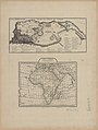
 Carte d'Afrique dressée - par le Sr d'Anville... - btv1b8468555w.jpg 4,478 × 3,682; 3.1 MB
-

-

-


_;_Grav%C3%A9_par_F._Baillieul_l%27ain%C3%A9_-_btv1b84929394.jpg)
.jpg)


